closedWild River Road, Shelburne Trail, parts of High Water Trail; Kenduskeag TrailCoos County, New HampshireAbout 821 acres, 29% contained (Nov 8); full containment targeted Nov 12checked Nov 9
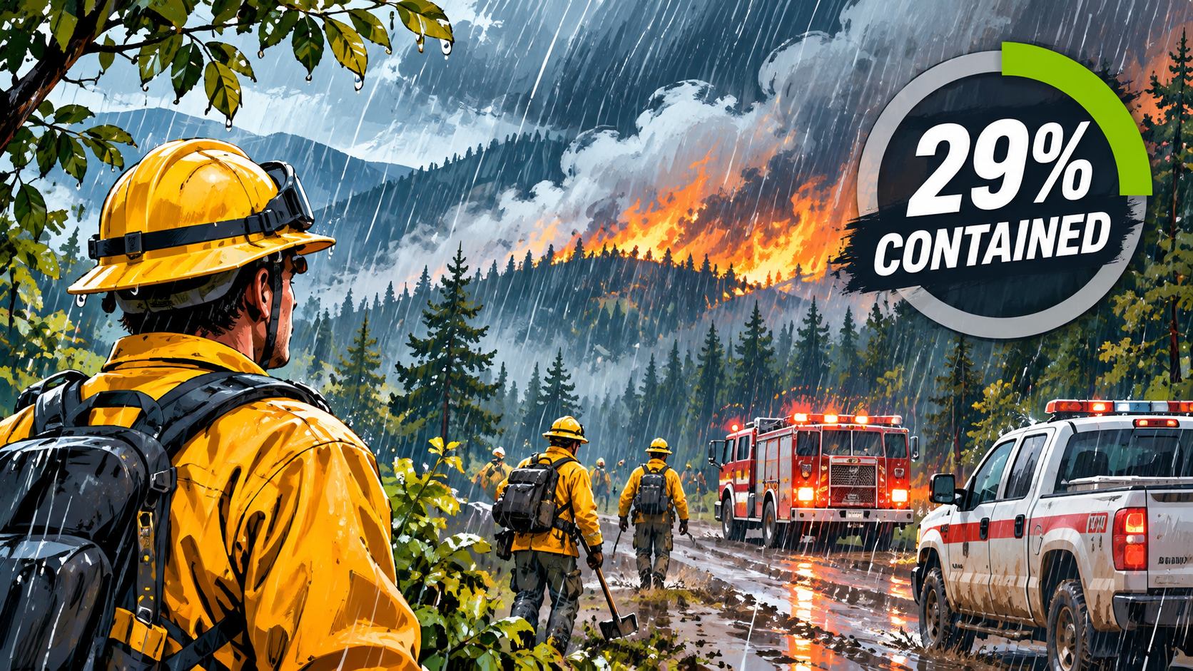
Rain Saturday night, heavier than forecast, and cooler weather slowed the Wild River Fire near Gorham, New Hampshire, which had burned about 821 acres and is expected to stay within an 856-acre footprint, the Boston Globe reported Sunday, November 8. The White Mountain National Forest put containment at 29 percent on Sunday, up from 20 percent Friday, Connecticut Public reports, and crews expect full containment by Thursday, November 12.
The fire was still burning overnight, "when fire activity is usually tempered due to higher relative humidity," the Forest Service said, and the soil remains dry well below the surface. The agency says the fire will not be declared out until a season-ending event, such as several inches of rain or snow. The forest closure around the fire remains in effect. A public meeting is set for Tuesday, November 10, from 6 to 7 p.m. at Shelburne Town Hall, 74 Village Road, and online.
closedWild River Road, Shelburne Trail, parts of High Water Trail; Kenduskeag TrailCoos County, New Hampshire856 acres, 20% contained (Nov 6); full containment targeted by Nov 12checked Nov 8
The Wild River Fire near Gorham, New Hampshire, was 20 percent contained as of Friday evening, November 6, and had not grown since Tuesday, WGME reported; crews hope to fully contain it by Thursday, November 12. New Forest Service mapping put it at 856 acres, NHPR reported, and officials believe it was likely human-caused. The White Mountain National Forest closure of Wild River Road, the Shelburne Trail and sections of the High Water Trail was still in effect in the latest notices; check the forest's alerts before heading to the Wild River area.
closedWild River Road, Shelburne Trail, parts of High Water Trail; Kenduskeag TrailCoos County, New HampshireFire 856 to 1,000 acres, 11% contained; A.T. openchecked Nov 6
The Wild River Fire, burning in steep terrain about 7 miles southeast of Gorham, New Hampshire, and a mile west of the Maine line, was 11 percent contained as of Friday, November 6. Size estimates have varied: the Forest Service put it at 982 acres on November 4, the Appalachian Trail Conservancy cited about 1,000 acres on November 5, and WMUR, citing the Forest Service, reported 856 acres on Friday. The fire was first reported Sunday afternoon, November 1. Its cause is under investigation, and the Forest Service believes it was human-caused.
A White Mountain National Forest closure order bars public entry to the fire area, including all of Wild River Road, the entire Shelburne Trail and sections of the High Water Trail and other trails; the exact boundary is on the forest's Wild River Fire alert page. The Appalachian Trail Conservancy says the A.T. remains open where it crosses the Carter-Moriah Range near Gorham, several miles west of the fire, but the Kenduskeag Trail is closed and hikers may see or smell smoke.
Officials say the fire poses no significant threat to life or property. The area is in moderate drought, and the Forest Service and the conservancy are asking visitors to take care with campfires.
advisorySouth Rim: Stage 1 fire restrictions; Stage 4 water conservation; North Rim Stage 2 staysGrand Canyon National Park, ArizonaMather Campground fires only in established rings; bring your own waterchecked Nov 4
Grand Canyon National Park lifted Stage 2 fire restrictions on the South Rim effective immediately on November 4, the park said; they had been imposed because little water was available for fighting fires, and continued water hauling now supplements the South Rim's supply. Stage 1 restrictions remain on the South Rim, and campfires at Mather Campground are allowed only in established fire rings. Stage 4 water conservation measures also stay in place, so bring your own water. On the North Rim, Stage 2 restrictions remain for the rest of the 2026 season.
advisoryPCH southbound lane closures, Reef Point Dr to Irvine Cove DrCrystal Cove State Park, Orange County, CaliforniaEmergency slope repairs; closures in place until work is completechecked Nov 3
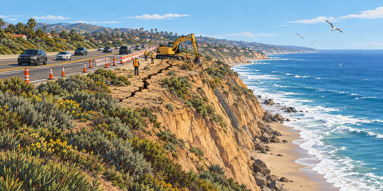
Southbound lanes of Pacific Coast Highway are partly closed between Reef Point Drive and Irvine Cove Drive while Caltrans stabilizes a 360-foot fracture in the slope above the beach.
An illustration of a cracked coastal bluff beside a highway. Not a photo of the Crystal Cove site. Illustration
A crack in the bluff that holds up Pacific Coast Highway at El Morro, beside Crystal Cove State Park between Newport Beach and Laguna Beach, measures as much as 360 feet long and two feet wide, Caltrans says, according to Surfer. Caltrans closed the southbound right lane between Reef Point Drive and Irvine Cove Drive in mid-October and later added more partial closures as it moved to the second phase of emergency stabilization, Fox 11 reports. The closures stay in place until repairs are complete.
Caltrans has secured $4 million in initial emergency funding for a three-phase project that includes protecting the slope from wave erosion before winter storms, with a long-term fix to follow. The pressure from the ocean has been unusual: NOAA says El Niño-related ocean waves helped push water levels at gauges in Los Angeles, San Diego Bay, Santa Barbara and La Jolla to all-time records in late October, Surfer reports. On October 27, Gov. Gavin Newsom ordered a Highway 1 task force to prepare vulnerable stretches of the coast highway for winter.
Expect slower traffic through the area, and stay off the bluff edge and away from the base of the slope on the beach below. Check QuickMap.dot.ca.gov for current lane closures.
closedTioga Road and Glacier Point Road, temporarily closed for snowYosemite National Park, CaliforniaNo overnight parking along either road; call 209-372-0200 for updateschecked Nov 1
Yosemite has temporarily closed Tioga Road, the continuation of Highway 120 through the park, and Glacier Point Road because of snow from this weekend's storm, the park's conditions page shows, with no overnight parking along either road. Tioga Road usually closes for the season sometime in November and stays closed until late May or June; when it's closed you can't reach Tuolumne Meadows or enter the park from the east. Snow can also close Wawona Road at times. For current road status and chain controls, call 209-372-0200 (press 1, then 1) before you drive.
Up to 18 inches in the Sierra high country and Colorado's San Juans and up to two feet in Utah's Cottonwood Canyons, with chain controls and difficult travel through Monday.
The first widespread mountain snowstorm of the season is crossing the West this weekend, and the National Weather Service has winter storm warnings and advisories from the Sierra Nevada to the Rockies.
In California, a winter weather advisory runs until 7 a.m. Sunday for Yosemite outside the valley, Sequoia and Kings Canyon, with 4 to 8 inches between 7,500 and 9,500 feet and up to 18 inches higher up. The northern Sierra, including Interstate 80 and Highway 50, could see up to 10 inches above 7,000 feet, with chain controls possible, and the Lake Tahoe area 2 to 5 inches above 7,000 feet. Nevada's Ruby Mountains and East Humboldt Range are under a winter storm warning through Sunday evening, with 12 to 16 inches above 7,500 feet and snow-covered roads through Lamoille Canyon.
Farther east, Utah's Wasatch south of Interstate 80 and the western Uintas expect 8 to 12 inches from Saturday night to Monday morning, with 18 to 24 inches possible above 10,000 feet in Little and Big Cottonwood canyons. Colorado's San Juan Mountains are under winter storm warnings from Sunday to Monday, with 12 to 18 inches above 10,000 feet and gusts to 45 mph, and lighter snow is forecast for the central Colorado mountains, Idaho's Sun Valley area and Wyoming's Wind River Range.
If you are heading up: high mountain roads such as Yosemite's Tioga Road can close temporarily or for the season after storms like this, so check park and state road status before you drive, carry chains, and tell someone your plans. Backpackers in the high country should expect winter conditions and check the latest forecast.
openHatteras Island open to visitors; NC 12 open at Pea Island; Frisco and Cape Point campgrounds openDare County, North CarolinaSince 4 p.m. Oct 29; expect slow traffic and storm debrischecked Oct 30
Dare County lifted the visitor evacuation Thursday as NC 12 reopened at Pea Island, a day ahead of the state's target. Frisco and Cape Point campgrounds and most beach ramps are open.
Hatteras Island has reopened to visitors, with Frisco and Cape Point campgrounds welcoming guests again.
Hatteras Island is open to visitors again. Dare County lifted its visitor evacuation order on Thursday, October 29, as N.C. 12 reopened near the Pea Island Visitor Center, a day ahead of the transportation department's Friday target, ending a closure that began with overwash on October 22. Visitors can again drive N.C. 12 across Pea Island and use the Ocracoke-Hatteras ferries, WRAL reports, though traffic remains slow through the repaired section.
Cape Hatteras National Seashore reopened its Frisco and Cape Point campgrounds at 4 p.m. Thursday, and most off-road vehicle ramps are open again, the park said; current ramp status is at go.nps.gov/beachaccess. The park asks visitors to use caution on Rodanthe beaches, where several oceanfront houses are still threatened and storm debris may be on the beach and in the water.
The road is still fragile. The state has said a permanent two-lane repair is weeks away and is planning to move about a mile of the highway away from the surf; check DriveNC.gov and the county before you go, especially around high tide.
closedNC 12, Marc Basnight Bridge to Rodanthe; Hatteras Island to visitorsDare County, North CarolinaOne-lane detour targeted by noon Fri Oct 30; two lanes weeks awaychecked Oct 29
Crews were set to begin paving a one-lane detour on NC 12 at the Pea Island Visitor Center on Thursday, and the state transportation department is still aiming to open it to alternating one-way traffic by noon Friday, WCTI reports. Two-lane service is still weeks away, the Outer Banks Voice reports. Hatteras Island remains closed to visitors under Dare County's state of emergency, and the 24-hour emergency ferry from Stumpy Point to Rodanthe continues; anyone with a reservation should keep checking with their rental company and the county before traveling.
Correction, Oct. 30, 2026. Update: N.C. 12 reopened and Dare County lifted the visitor evacuation at 4 p.m. on October 29, a day earlier than the state's target, after this brief was published. Hatteras Island is open to visitors.
advisoryFlash flood watches: Big Bend and West Texas mountains, Sedona and Oak Creek, Superstitions, Sacramento MtnsArizona · New Mexico · West TexasThrough Fri Oct 30; burn scars and slot canyons most at riskchecked Oct 29
Tropical moisture is bringing storms to Big Bend, the Guadalupe and Davis mountains, Sedona's canyons, the Superstitions and New Mexico burn scars. Stay out of washes, slot canyons and swimming holes.
The National Weather Service has flood and flash flood watches across much of the Southwest's best hiking country as another surge of tropical moisture meets an incoming storm system. In West Texas and southeast New Mexico, a watch runs through Friday afternoon for areas including the Chisos Basin and Lower Brewster County in Big Bend, the Guadalupe and Delaware mountains, the Davis Mountains and the Marfa Plateau. In New Mexico's Sacramento Mountains, the Albuquerque office warned of storms repeatedly crossing burn scars Thursday afternoon and evening, with 1 to 1.5 inches of rain possible.
In Arizona, the Flagstaff office has a flash flood watch from 10 a.m. to 10 p.m. Friday for Yavapai County, including Oak Creek and Sycamore canyons around Sedona, and northern Gila County, where soils are still saturated from flooding last week; it warns of flooding in creeks, normally dry washes, swimming holes and recently burned areas, with half an inch to an inch of rain and up to two inches in storms. The Phoenix office has watches Friday for the Superstition and Mazatzal mountains, the Tonto Basin and the Phoenix metro area.
If you are headed out: skip slot canyons and narrow washes until the watch ends, since a storm miles away can send water through a dry canyon under clear sky. Camp well above creek beds, never drive or walk into water over a low-water crossing, and check the latest from the Weather Service and the park or forest before you go. Big Bend and Guadalupe Mountains national parks post road and trail closures on their alerts pages.
closedNC 12, Marc Basnight Bridge to Rodanthe; Hatteras Island to visitorsDare County, North CarolinaNCDOT aims for a one-lane detour by noon Fri Oct 30; emergency ferry 24/7checked Oct 28
Crews have begun tearing out damaged pavement at Pea Island, but king tides through Thursday could push more water over the road. Visitors are still barred, and the state plans to move a mile of the highway inland.
The North Carolina Department of Transportation says it aims to reopen N.C. 12 at the Pea Island Visitor Center with a one-lane detour, controlled by flaggers or automated signals, by noon Friday, October 30, WAVY reports. Crews have begun rebuilding dunes, removing damaged pavement and grading the roadbed, but standing water and continued overwash are slowing the work, and king tides through Thursday could bring more flooding, according to the Island Free Press. Once the single lane is open, the department plans to add sandbags along the dune line and then pave two full lanes.
Visitors still cannot enter Hatteras Island. Dare County's state of emergency and visitor evacuation remain in effect, entry is limited to its Priority One, Two and Three categories, and the county says no date has been set for visitors to return. Anyone with a reservation should contact their rental company and not travel toward the island. The 24-hour emergency ferry between Stumpy Point and Rodanthe had carried 3,117 people and 1,881 vehicles as of Monday; priority access does not mean priority loading, and those who need it must ask Dare County Emergency Management.
Longer term, the department is drawing up plans to move about a mile of the highway near the visitor center away from the surf, a spokesman said, though the new alignment has not been decided. N.C. 12 is open north of Oregon Inlet and south of Rodanthe through Hatteras Village and on Ocracoke.
openSouth Kaibab below The Tipoff; River Trail; Bright Angel, Mile-and-a-Half Resthouse to Havasupai Gardens (hikers only)Grand Canyon National Park, ArizonaBlack and Silver bridges, Phantom Ranch, North Kaibab still closedchecked Oct 27
Bright Angel reopens to hikers between Mile-and-a-Half Resthouse and Havasupai Gardens. Phantom Ranch, both river bridges and the North Kaibab stay closed, and there is no water on the trail all winter.
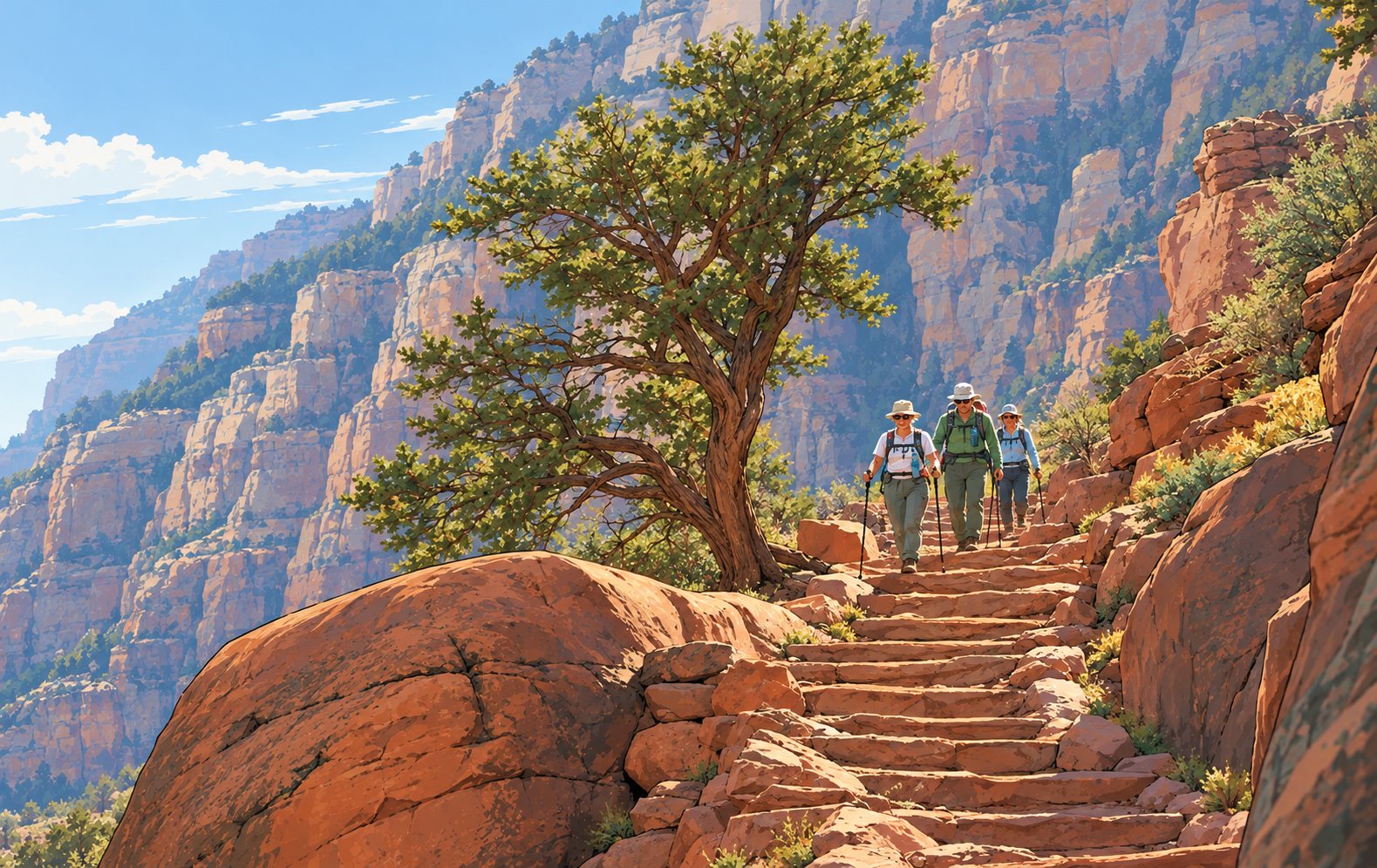
An illustration of hikers on an inner-canyon trail. Not a photo of the South Kaibab or River trails. Illustration
Several inner-canyon trails at Grand Canyon National Park have reopened after repairs to flood damage, the park said October 26: the South Kaibab Trail below The Tipoff, the entire River Trail connecting the South Kaibab and Bright Angel trails, and the Bright Angel Trail between Mile-and-a-Half Resthouse and Havasupai Gardens. That Bright Angel section is open to hikers only; it stays closed to mules and other stock while crews repair more damage.
Expect intermittent closures and delays on the Bright Angel as technical repairs continue, and follow crew instructions. Water is off at Mile-and-a-Half and Three-Mile resthouses and at Havasupai Gardens for the rest of the winter, so carry all the water you need plus a way to filter or treat more.
Still closed: the Black Bridge and the Silver Bridge over the Colorado River, Phantom Ranch, and the entire North Kaibab Trail, which means rim-to-river trips can no longer cross to the north side. The park warns that rescue in the inner canyon can be delayed and is not guaranteed; plan conservatively.
Gulf Islands National Seashore reopened the Naval Live Oaks Area in Florida on October 26, the last section closed by Hurricane Isaias, and every area of the park is now open, including Okaloosa, Opal Beach, Perdido Key, Fort Pickens and Fort Barrancas, the park said. Superintendent Rick Clark said Isaias caused no substantial damage to buildings or infrastructure. Use caution on trails and stay out of any signed closed areas.
closedBlue Ridge Parkway: Roanoke Mountain Loop; MP 344.2–355.3 (Helene); MP 63.5–63.9 at the James River Bridge, detouredVirginia · North CarolinaPeaks of Otter, MP 76.4–85.9, open again; status 6:37 a.m. ET Oct 26checked Oct 26
The Blue Ridge Parkway between milepost 76.4 and 85.9, from the Apple Orchard parking area to Peaks Road and including Peaks of Otter Lodge, is open again, according to the park's road status page as of 6:37 a.m. Eastern Monday, October 26. Still closed: the Roanoke Mountain Loop at milepost 120.3, until further notice; milepost 344.2 to 355.3, from NC 80 to Mount Mitchell State Park, because of Hurricane Helene damage; and milepost 63.5 to 63.9 around the James River Bridge for rehabilitation, with a signed detour between mileposts 61.4 and 64. Hiking is prohibited at Crabtree Falls. The status page is updated each morning and can change during the day.
closedArea east of Wawona Road, south of Glacier Point Road, north of Wawona, east to the Bridalveil Creek trailheadWawona, Mariposa Co., CaliforniaChilnualna Falls trail reopened; rest of the area still closedchecked Oct 26
The trail to the top of Chilnualna Falls has reopened, Yosemite's current conditions page says. Still closed after the Dome Fire, which was fully contained October 18: the area east of Wawona Road, south of Glacier Point Road and north of Wawona, extending east to the Bridalveil Creek trailhead, south of the Ostrander Lake trail. Glacier Point Road itself is open, with no overnight parking. The park's public information map shows the closure boundary.
closedWonderland Trail, Carbon River Suspension Bridge to White River Campground; Northern Loop; Grand Park trailsMount Rainier National Park, WashingtonWonderland Complex fires still active; Sunrise and White River roads closed for winterchecked Oct 26
Mount Rainier's Wonderland Trail remains closed from the Carbon River Suspension Bridge to White River Campground, along with the Northern Loop Trail and all trails in the Grand Park area, until further notice, the park says. The Grand Park Fire 2 and the West Fork, Garda Falls and Pigeon fires, known together as the Wonderland Complex, are still active and expected to burn until extinguished naturally. The Sunrise and White River roads have also closed for the winter season.
Cape Hatteras National Seashore will close part of the Sandy Bay parking lot from November 2 to about late January 2027 while Cape Hatteras Electric Cooperative replaces 15 wooden transmission poles with concrete structures between Sandy Bay and Hatteras Village, the park said October 26. Expect brief, intermittent lane closures on NC 12 when poles are delivered and removed. Access to Pamlico Sound for waterfowl hunting, fishing and other recreation stays open; avoid active work areas.
openTrails in the Grant Grove area, Kings Canyon National ParkKings Canyon NP, CaliforniaOpen; check the Kings Canyon Visitor Center for conditionschecked Oct 26
Trails within the Grant Grove area of Kings Canyon National Park are open, the park's conditions page says, after the 482-acre prescribed burn that began October 17 closed several of them on a rolling basis. The Kings Canyon Visitor Center has the most current trail conditions; smoke can linger near burned areas for days.
closedNC 12, Marc Basnight Bridge to Rodanthe; Hatteras Island to visitorsDare County, North CarolinaNo timeline; emergency ferry for permit holderschecked Oct 25
The damaged stretch near the Pea Island Visitor Center now exceeds 1,100 feet. Hatteras Island stays closed to visitors, and emergency ferry lines are long.
Ocean water crossed NC 12 near the Pea Island Visitor Center again at Sunday morning's high tide, the seventh straight day of ocean impacts on the same damaged stretch, the Island Free Press reports. The damage now covers more than 1,100 feet of highway, and there is still no confirmed timeline for reopening the road between the Marc Basnight Bridge and Rodanthe.
Dare County's state of emergency and mandatory evacuation for Hatteras Island visitors remain in effect, with no date announced for visitor entry. Only people in the county's Priority One, Two and Three categories may enter. Visitors already on the island can leave on the emergency ferry from Rodanthe to Stumpy Point but cannot return, and the same restrictions apply on the Cedar Island and Swan Quarter ferries through Ocracoke.
NC 12 is open south of Rodanthe through Hatteras Village and on Ocracoke. Ferry lines are long; residents with medical appointments or other time-sensitive travel can ask the county for priority boarding, though it is not guaranteed. No evacuation has been ordered for residents or for areas north of Oregon Inlet.
closedNC 12, Marc Basnight Bridge to Rodanthe; Hatteras Island to visitorsDare County, North CarolinaEmergency ferry Stumpy Point–Rodanthe; no reopening timelinechecked Oct 23
Dare County says there is no timeline for reopening NC 12 between the Marc Basnight Bridge and Rodanthe, and its state of emergency and visitor evacuation for Hatteras Island remain in effect. The emergency ferry between Stumpy Point and Rodanthe runs on a fixed NCDOT schedule from Friday for permit holders; visitors may use it to leave but not to return. Hyde County residents with documentation may use it to reach Ocracoke, where limited Hatteras–Ocracoke ferry service has resumed and NC 12 is open. The county's next bulletin is due by noon Friday.
closedNC 12, Marc Basnight Bridge to Rodanthe; Hatteras Island to visitorsDare County, North CarolinaEmergency ferry Stumpy Point–Rodanthe for permitted travelers onlychecked Oct 22
With a damaged stretch of NC 12 still cutting the road between the Marc Basnight Bridge and Rodanthe, the North Carolina Department of Transportation started emergency ferry service between Stumpy Point on the Dare County mainland and Rodanthe at 5 a.m. Thursday, October 22, Dare County said. Three boats are running around the clock, and each trip takes about two hours, WCTI reports.
The ferry is not for visitors. Dare County's state of emergency and its mandatory evacuation of Hatteras Island visitors remain in effect, and only people in the county's Priority One, Two and Three reentry categories may board for Rodanthe: essential personnel with a permit, permanent Dare County residents, critical-business staff, nonresident Hatteras Island property owners and island business employees. Anyone can leave the island.
The county says visitors with Hatteras Island reservations should not travel toward the island, and that it will announce when restrictions are lifted. The Weather Service's beach hazards statements for the Outer Banks run through Thursday evening as the storm winds down; NCDOT posts NC 12 updates on DriveNC.gov.
closedNC 12, Marc Basnight Bridge to Rodanthe; Hatteras Island to visitorsDare County, North CarolinaState of emergency in effect; no reopening timechecked Oct 21
North Carolina transportation crews were assessing pavement damage on NC 12 at the Pea Island Visitor Center on Wednesday, October 21, and rebuilding protective dunes and adding sand along undamaged shoulders, WNCT reported, citing NCDOT. The highway remains closed from the Marc Basnight Bridge to Rodanthe, with significant blown sand in the canal zone, and NCDOT is asking people to avoid Pea Island.
Dare County's state of emergency for Hatteras Island remains in effect and visitors are still not allowed onto the island. Farther south, NC 12 is open on Ocracoke Island.
The worst of the storm has eased: the Weather Service's beach hazards statements for the Outer Banks run through Wednesday evening, and a minor coastal flood advisory through early Thursday. Dare County said its next bulletin would come by noon Wednesday; check DareNC.gov/Storm before traveling.
closedNC 12, Marc Basnight Bridge to Rodanthe; Hatteras Island to visitors; seashore ORV rampsDare & Hyde Cos., North CarolinaVisitor entry resumes only when Dare County announces itchecked Oct 20
Ocean overwash has closed North Carolina Highway 12 between the Marc Basnight Bridge over Oregon Inlet and Rodanthe, Dare County said, and the mandatory evacuation for Hatteras Island visitors remains in effect.
Visitors are not allowed onto Hatteras Island, and the county says visitor entry will resume only after the storm has passed and NC 12 is no longer threatened by overwash. Residents and people with Priority One, Two or Three reentry permits are authorized to enter, but that does not let anyone drive through the closed section; everyone must follow NCDOT barricades. The evacuation applies only to visitors on Hatteras Island, not to residents or to the beaches north of Oregon Inlet.
On Cape Hatteras National Seashore, the off-road vehicle ramps on Hatteras and Ocracoke islands are listed as closed due to weather on the park's conditions page, updated October 20. If you have a Hatteras reservation, the county's advice is not to travel toward the island until it announces that restrictions are lifted.
Dare County's emergency information line is 252-475-5655, and its bulletins are at DareNC.gov/Storm.
openGulf Islands NS: Fort Pickens day use, Opal Beach, Perdido Key, Fort Barrancas, Mississippi DistrictEscambia & Santa Rosa Cos., Florida · Mississippi coastFort Pickens Campground, Naval Live Oaks and Okaloosa still closedchecked Oct 19
Gulf Islands National Seashore has reopened most of its Florida District after Hurricane Isaias. The Fort Pickens Area opened for day use at 9 a.m. Sunday, October 18, and remains under a boil-water notice. The Opal Beach complex in the Santa Rosa Area reopened October 17, and the Mississippi District, Perdido Key and Fort Barrancas reopened October 14.
Still closed because of large amounts of downed trees in visitor areas: the Naval Live Oaks Area, including park headquarters and all its trails; the Fort Pickens Campground and the Battery Worth pavilion; and the Okaloosa Area.
Superintendent Rick Clark said the park fared relatively well compared with past hurricanes, with no substantial damage to buildings, roads, trails or utilities in either district. Watch for sand and vegetation across roads and trails, and stay out of signed closed areas.
closedHatteras Island to visitors; Ocracoke ferries; seashore campgrounds, ORV routes, lighthouse climbingDare & Hyde Cos., North CarolinaCoastal flood warning to 5 p.m. Tue; surf 9–14 ft to Thuchecked Oct 18
Hatteras Island remains closed to non-resident visitors under Dare County's state of emergency and evacuation order, Cape Hatteras National Seashore said Sunday, and Ocracoke Island cannot be reached because all ferry service from Hatteras Island, Swan Quarter and Cedar Island is suspended.
All seashore campgrounds, off-road vehicle routes and lighthouse climbing stay closed. Fort Raleigh National Historic Site and Wright Brothers National Memorial reopen at 9 a.m. Monday, October 19, and other facilities on the northern beaches are on their regular seasonal schedules.
The Weather Service now has coastal flood warnings for Hatteras and Ocracoke islands until 5 p.m. Tuesday, for 2 to 4 feet of water above ground in low-lying areas near the shoreline and sounds. The high surf advisory runs until 6 a.m. Thursday, with breakers of 9 to 14 feet on Hatteras Island, 9 to 12 feet on the Northern Outer Banks and 6 to 9 feet on Ocracoke. Virginia Beach and eastern Currituck County have 8 to 14 feet through Wednesday evening.
The park repeats its warning about the compromised oceanfront houses in Rodanthe: if one collapses, avoid the site and the beach and water downwind of it. Road conditions are on drivenc.gov.
closedTrails in the Dome Fire footprint: south- and eastbound trails off Glacier Point Road, Ostrander, Mono Meadow, Buena VistaWawona, Mariposa Co., California6,788 acres, 100% contained; trail closures not yet liftedchecked Oct 18
The Dome Fire in Yosemite is 100 percent contained at 6,788 acres, according to the federal incident report filed Saturday evening, with 235 people still assigned. Containment is not the same as reopening: the park has not announced any change to the trail closures inside the fire footprint, including Ostrander, Mono Meadow and Buena Vista, and its last release still listed them closed. Glacier Point Road and the Chilnualna Falls, Alder Creek, Four Mile and Panorama trails are open. Check Yosemite's conditions page before heading into the burned area.
closedCape Hatteras National Seashore campgrounds, ORV ramps and facilities; Fort Raleigh; Wright BrothersDare & Hyde Cos., North CarolinaClosed from noon Oct 17; Hatteras Island visitors under mandatory evacuationchecked Oct 17
Cape Hatteras National Seashore closed its campgrounds, off-road vehicle ramps and visitor facilities at noon Saturday, October 17, along with Fort Raleigh National Historic Site and Wright Brothers National Memorial, the Park Service said. They will reopen after conditions improve and post-storm assessments are done.
Dare County has declared a state of emergency and ordered a mandatory evacuation of visitors from Hatteras Island, and Hyde County, which includes Ocracoke, has issued an urgent warning to residents, property owners and visitors, according to the park.
The Weather Service expects a prolonged low-pressure system to affect eastern North Carolina from this weekend into next week, with north to northeast gusts of 45 to 55 mph, high surf, ocean overwash and coastal flooding. Wind, coastal flood, high surf and storm-force wind watches and advisories are in effect.
Several privately owned oceanfront houses in Rodanthe are structurally compromised and at risk of collapse, the park warns, with exposed septic systems. If one collapses, stay away from the site and downwind of it, including in the water, because debris can travel for miles along the seashore. For roads, use drivenc.gov; for forecasts, weather.gov/mhx.
advisoryGrant Grove Day Ride Loop (Oct 17); General Grant Tree Trail, North Grove Loop, Grant Tree Road (Oct 18); part of Sunset Trail (Oct 19)Kings Canyon National Park, CaliforniaPrescribed burn from Oct 17; reopen when clearedchecked Oct 17
The Grant Grove prescribed burn in Kings Canyon National Park, first planned for October 13, now begins October 17, weather permitting, the park said in an update. It covers 482 acres, a little less than the 521 acres first announced.
Closures roll out over three days. The Grant Grove Day Ride Loop Trail closes October 17. The General Grant Tree Trail, the North Grove Loop Trail and Grant Tree Road close October 18, so the General Grant Tree itself is off limits from Sunday. Portions of the Sunset Trail close October 19. Everything reopens once it is cleared of hazards.
Smoke may be visible during and after the burn and can affect visibility and air quality; AirNow.gov has current readings.
Olympic National Park crews will remove the temporary bridge connecting the Quinault North Shore Road and South Shore Road on October 22. It spans a culvert vulnerable to winter storms and high water, and taking it out lets the park restore access once the highest risk of damage has passed. Through the winter, reach the Graves Creek area by the South Shore Road.
Olympic National Park's fire crews plan to burn debris piles in the Mora, Hoh, Elwha and Quinault maintenance areas beginning October 20, conditions permitting. Smoke may be visible from nearby trails and roads and can reduce visibility and air quality; fire.airnow.gov has current readings. The debris comes from containing the Mount Tom Creek Fire, clearing fuels around park buildings and road maintenance.
Two dead snowshoe hares found in Glacier National Park's Many Glacier Valley have tested positive for tularemia, a rare but serious bacterial disease, the park said October 15. One was found September 26 in the Park Service staff housing area at Many Glacier, and the other September 30 along the trail to the Swiftcurrent Falls viewing area.
Tularemia occurs naturally and is most often spread by bites from infected ticks or flies. People and pets can also catch it from handling infected animals, from contaminated food or water, or by breathing bacteria released from disturbed carcasses. Person-to-person spread is rare.
The park's precautions: use insect repellent and check yourself, children and pets for ticks; wash your hands often; keep away from wildlife and do not touch carcasses; drink only treated or boiled water; and avoid anything, like mowing or trimming, that could disturb dead animals. Report dead animals to park staff.
Symptoms in people include fever, chills, aches, headache, dry cough, chest pain, swollen lymph nodes and sores at a tick bite. Anyone who develops them within two weeks of visiting should see a doctor and mention possible tularemia exposure; it is treatable with antibiotics.
closedTrails in the Dome Fire footprint: south- and eastbound trails off Glacier Point Road, Ostrander, Mono Meadow, Buena VistaWawona, Mariposa Co., California6,788 acres, 95% contained; Glacier Point Road openchecked Oct 16
The federal incident report filed Thursday evening, the day Yosemite was scheduled to take command of the Dome Fire back from the interagency team, shows 278 people still assigned, down from 524 a day earlier. The fire holds at 6,788 acres and 95 percent contained. Glacier Point Road and the Chilnualna Falls, Alder Creek, Four Mile and Panorama trails are open; the trails inside the fire footprint, including Ostrander, Mono Meadow and Buena Vista, remain closed.
closedTrails in the Dome Fire footprint: south- and eastbound trails off Glacier Point Road, Ostrander, Mono Meadow, Buena VistaWawona, Mariposa Co., California6,788 acres, 95% contained; Glacier Point Road openchecked Oct 15
California Interagency Incident Management Team 4 is scheduled to hand command of the Dome Fire back to Yosemite National Park today. The fire is 95 percent contained at 6,788 acres with no perimeter change in several days, and staffing is down to 524 people in the latest federal report. Crews are patrolling, hauling out hose and equipment by mule and helicopter, and repairing hand lines to limit erosion. Warmer, drier weather with light winds holds through today. Glacier Point Road is open; every trail inside the fire footprint, including Ostrander, Mono Meadow and Buena Vista, stays closed, while Chilnualna Falls, Alder Creek, Four Mile and Panorama are open.
openU.S. 441/Newfound Gap Road; Carlos Campbell Overlook closedSevier Co., Tennessee · Swain Co., North CarolinaNot on park closure list Oct 13; no reopening releasechecked Oct 13
Great Smoky Mountains National Park's road closure page, updated October 13, no longer lists U.S. 441, Newfound Gap Road, which the park closed Friday night ahead of Hurricane Isaias, and the Blue Ridge Parkway's status table also shows it open. The park has not issued a release announcing the reopening. The closure page does list the Carlos Campbell Overlook on Newfound Gap Road as temporarily closed while crews assess cracks in the pavement and sidewalk, and Mingus Mill as closed for rehabilitation. Cosby Knob Shelter on the Appalachian Trail remains closed for bear activity. If you are driving across the park soon after the storm, check the park's road closure map first; the main switchboard is 865-436-1200.
closedBlue Ridge Parkway: MP 76.4–85.9 incl. Peaks of Otter Lodge; Roanoke Mountain Loop; Helene closure MP 344.2–355.3Virginia · North CarolinaStatus as of 7:35 a.m. ET Oct 13checked Oct 13
The Blue Ridge Parkway's last weather closure from Hurricane Isaias, milepost 455.7 to 469.1 from Soco Gap to U.S. 441 at the Smokies, is no longer listed as closed, according to the Parkway's road status as of 7:35 a.m. Tuesday.
One Virginia section that reopened Monday afternoon is closed again: milepost 76.4 to 85.9, from the Apple Orchard parking area to Peaks Road (VA 43), including Peaks of Otter Lodge, listed as "closed temporarily" with no reason or reopening time given. If you are booked at the lodge, call ahead.
Also still closed: Roanoke Mountain Loop, the Forest Service's Stoney Fork access road at milepost 367.6, and the Hurricane Helene section from NC 80 to Mount Mitchell State Park, milepost 344.2 to 355.3, where all recreation is prohibited. Great Smoky Mountains National Park has not posted an update on Newfound Gap Road since closing it Friday; check with the park before driving it. The Parkway's status can change through the day.
closedTrails in the Dome Fire footprint: south- and eastbound trails off Glacier Point Road, Ostrander, Mono Meadow, Buena VistaWawona, Mariposa Co., California6,788 acres, 95% contained; Glacier Point Road openchecked Oct 13
Update, 8:15 p.m. Tuesday: The federal incident report filed this evening raises containment to 95 percent, from 86 percent this morning, with 596 people still assigned, down from 746. The acreage is unchanged at 6,788. Closures have not changed.
Containment on the Dome Fire has reached 86 percent, the incident's InciWeb page says, with no change to the perimeter in several days. The fire stands at 6,788 acres. Activity is minimal, and any smoke visible is from pockets of heat in the interior. The federal incident report shows 746 people still assigned, down from more than 900 last week, and an estimated final cost of $60 million.
The work now is cleanup. Crews, mule trains and helicopters are removing hose and equipment from remote wilderness. Suppression repair has begun: along secondary hand lines, crews are pulling berms back to match the terrain and scattering vegetation to hide the lines and limit erosion. California Interagency Incident Management Team 4 is scheduled to hand command back to Yosemite on Thursday, October 15.
After a cold Tuesday with highs in the 40s, a warming, drying trend brings highs in the 50s and near 60 on Wednesday and Thursday, with light winds.
Glacier Point Road is open. Every trail inside the active fire footprint remains closed, including all south- and eastbound trails from Glacier Point Road, Ostrander, Mono Meadow and Buena Vista. The Chilnualna Falls, Alder Creek, Four Mile and Panorama trails are open.
closedBlue Ridge Parkway: MP 455.7–469.1, Soco Gap to U.S. 441; Roanoke Mountain Loop; Helene closure MP 344.2–355.3Virginia · North CarolinaWeather closure near the Smokies; status as of 1:59 p.m. ETchecked Oct 12
Update, 2 p.m. Eastern: Most of the Parkway has reopened. As of 1:59 p.m. Monday, the only weather closure left is milepost 455.7 to 469.1, from Soco Gap to U.S. 441 at the Smokies. The Virginia sections closed this morning for downed trees and rocks, including Peaks of Otter and the James River area, are listed open, as are Mount Mitchell State Park, Craggy Gardens and Beech Gap to Balsam Gap. Still closed for other reasons: the Helene section from NC 80 to Mount Mitchell (milepost 344.2 to 355.3), Roanoke Mountain Loop, and a short stretch at the James River Bridge (milepost 63.5 to 63.9) for bridge work. The Parkway's table now lists U.S. 441 through the Smokies as open but refers drivers to the Smokies for its status, and the Smokies had not posted a reopening when we checked. The original report from this morning follows.
Large sections of the Blue Ridge Parkway are closed after Hurricane Isaias, according to the Parkway's road status page as of 10:08 a.m. Monday. The park notes that status can change through the day.
In Virginia, the Parkway is closed in long blocks from milepost 29.1 at VA 603 (Irish Creek Road) south to milepost 105.8 at U.S. 460, for downed trees and rocks. The closed sections include the James River Visitor Center area, Apple Orchard and Peaks of Otter, including the lodge. A stretch between Peaks Road (VA 43) and Bearwallow Gap is not listed as closed. Roanoke Mountain Loop is closed until further notice.
In North Carolina, weather closures cover Mount Mitchell State Park and milepost 355.3 to 375.7 through Craggy Gardens to Bull Gap, milepost 423.2 to 443.0 from Beech Gap to Balsam Gap, and milepost 455.7 to 469.1 from Soco Gap to U.S. 441. The section from NC 80 to Mount Mitchell, milepost 344.2 to 355.3, remains closed from Hurricane Helene, with all recreation prohibited.
U.S. 441, Newfound Gap Road through Great Smoky Mountains National Park, is also still listed as closed; the Smokies closed it Friday night ahead of the storm. Check the Parkway's road closure page and its interactive map before driving, and expect more changes as crews clear trees.
closedTrails in the Dome Fire footprint: south- and eastbound trails off Glacier Point Road, Ostrander, Mono Meadow, Buena VistaWawona, Mariposa Co., California6,788 acres, 73% contained; Glacier Point Road openchecked Oct 12
The federal incident report filed Sunday evening puts the Dome Fire at 73 percent contained and 6,788 acres, with 906 personnel; the park had not posted a Monday update when this was written. Rain and snow showers are forecast through tonight. Glacier Point Road is open, and the trails inside the fire footprint, including Ostrander, Mono Meadow and Buena Vista, remain closed. All crews have been flown out of their wilderness spike camps by helicopter ahead of the storm, and crews have started hauling out about 12 miles of hose along with pumps, tanks, generators and fuel cans.
The Bouquet Fire is 93 percent contained at 1,048 acres, according to the federal incident report filed Sunday evening, with 46 people still assigned. All evacuations have been lifted and Rowher Flat is open, but the Drinkwater OHV area and forest roads 6N18 and 6N19 remain closed.
advisoryGeneral Grant Tree Trail, North Grove Loop, Grant Grove Day Ride Trail, part of North Boundary TrailTulare & Fresno Cos., CaliforniaPrescribed burn from Oct 13; temporary closures during ignitionschecked Oct 12
Sequoia and Kings Canyon National Parks plan to start a prescribed burn in the Grant Grove area on Tuesday, October 13, weather permitting. The burn covers 521 acres west of Highway 180, including areas near the General Grant Tree.
During ignitions, the General Grant Tree Trail, the North Grove Loop, the Grant Grove Day Ride Trail and a segment of the North Boundary Trail will be temporarily closed. The park says it will keep the closures as short as possible and reopen trails as soon as operations finish. Weather and air quality will be checked before ignitions, and the dates may change.
Much of the land around Grant Grove burned severely in the 2015 Rough Fire and the 2021 KNP Complex Fire. The park credits its long history of prescribed burning with sparing the grove the worst of both.
closedTrails in the Dome Fire footprint: south- and eastbound trails off Glacier Point Road, Ostrander, Mono Meadow, Buena VistaWawona, Mariposa Co., California6,805 acres, 69% contained; Glacier Point Road openchecked Oct 11
Every control line on the Dome Fire held through Saturday's wind, the Park Service says. Fire activity picked up with the gusts, but burning stayed in the interior and never threatened containment, which now stands at 69 percent. The park lists the fire at 6,805 acres, 24 fewer than Friday's 6,829; reported acreage is often revised as the perimeter is remapped, and the park did not explain the change. There are 926 people assigned.
With the fire largely held, the work is shifting. Crews will patrol the lines, mop up and begin hauling out equipment no longer needed, while mule trains keep supplying remote sections. Fire managers have cut back the number of spike camps in the wilderness ahead of the weather.
Southerly winds are a little stronger today, 10 to 20 mph with gusts of 20 to 35 mph. Rain showers are likely this afternoon and evening, with rain and snow showers likely tonight through Monday night.
Glacier Point Road, which reopened Saturday, stays open, but drivers should be ready for winter conditions at elevation. The trails inside the fire footprint remain closed, including those south and east of Glacier Point Road, Ostrander, Mono Meadow and Buena Vista.
The Appalachian Trail Conservancy is advising hikers to consider postponing trips on the southern part of the trail until Hurricane Isaias has passed. Its alert, posted Friday, says the storm's updated track brings heavy rain, flash flooding and high winds to the trail from Georgia through southwest Virginia, with possible heavy rain and flash flooding into central Virginia.
Areas hit by Hurricane Helene in 2024 are at particular risk because the landscape is still recovering. Wind can bring down trees and heavy rain can raise streams to dangerous levels and trigger landslides. Anyone on the trail during or right after the storm should stay well clear of standing dead, diseased or damaged trees, which can fall at any time.
Separately, Great Smoky Mountains National Park has closed Cosby Knob Shelter, at northbound mile 231.4, because of bear activity. Do not camp there or stop for breaks, the privy or lunch. Newfound Gap Road through the park has been closed since Friday night for the storm.
Check the National Hurricane Center and weather.gov before heading out, and the conservancy's trail updates page for closures as crews assess damage.
closedTrails in the Dome Fire footprint: south- and eastbound trails off Glacier Point Road, Ostrander, Mono Meadow, Buena VistaWawona, Mariposa Co., CaliforniaGlacier Point Road open; fire 6,829 acres, 61% containedchecked Oct 10
Glacier Point Road reopened at 7 a.m. Saturday, October 10, Yosemite National Park says. It had been closed for the Dome Fire since September, for smoke, visibility and firefighter access. The park asks drivers to go slowly and watch for firefighters working along the road.
The trails inside the fire are another matter. Every trail within the active fire footprint is still closed, including all of the south- and eastbound trails that start from Glacier Point Road, the Ostrander Lake Trail and everything south of it, and the Mono Meadow and Buena Vista trails. The Chilnualna Falls, Alder Creek, Four Mile and Panorama trails are open.
The fire held through Friday with no growth, at 6,829 acres and 61 percent contained with 935 people assigned. Crews finished critical line on the east side ahead of the weekend wind. That wind is today's test: south winds of 15 to 25 mph with gusts to 32 mph this afternoon, with patrols ready for any spot fires outside the lines.
Winter is close behind. A low-pressure trough sits over the area Sunday through Tuesday, with highs in the 40s and 50s, lows from the upper 20s to the low 40s, and rain likely by late Sunday. Anyone driving to Glacier Point this week should expect cold, wind and possibly snow at elevation. Fire restrictions remain in effect below 8,000 feet.
North Cascades National Park Service Complex plans to burn brush piles left from fighting the Border 2 and Sisi fires in Ross Lake and Lake Chelan national recreation areas through October and November, when weather and staffing allow. Smoke may be visible from roads and around Stehekin and Ross Lake and can settle in low areas overnight. The park says burns will only go ahead when the risk of fire spreading beyond the piles is low.
closedU.S. 441/Newfound Gap Road; Balsam Mountain CampgroundSevier Co., Tennessee · Swain Co., North CarolinaFrom 8 p.m. Oct 9; high wind warningchecked Oct 9
Great Smoky Mountains National Park closes U.S. 441, Newfound Gap Road, at 8 p.m. tonight because of strong winds expected from Hurricane Isaias and the risk of downed trees and debris. Balsam Mountain Campground closed at 5 p.m. The road crosses the Appalachian Trail at Newfound Gap.
The National Weather Service has a high wind warning for the area starting today, with gusts to 70 mph possible on the Tennessee side of the park and moderate rain parkwide. Isaias is forecast to come ashore on the northern Gulf Coast and then move across the Southeast this weekend; the National Hurricane Center has the current track and warnings.
Campers looking for an alternative to Balsam Mountain can use Smokemont or Deep Creek, which have sites available, the park says. Anyone heading into the backcountry or onto the AT this weekend should expect blowdown on trails and roads and check the park's current conditions page before going; the park has not said when the road will reopen.
closedGoing-to-the-Sun Road, Avalanche to Jackson Glacier OverlookFlathead & Glacier Cos., MontanaFrom 7 p.m. Oct 9; reopens when conditions allowchecked Oct 9
Glacier National Park closes the alpine section of Going-to-the-Sun Road at 7 p.m. tonight, from Avalanche to the Jackson Glacier Overlook, ahead of a storm forecast to bring rain, possible snow and gusting wind to the high country through Sunday, October 11. The park says the closed stretch may change as needed and will reopen when conditions improve.
That cuts off Logan Pass from both sides for the weekend. For road status by text, send GNPROADS to 333111.
Zion National Park reopened visitor access on the Zion-Mount Carmel Highway today, October 9, the park said. Part of the highway had been closed since September 30, when a large rock formation collapsed onto it, damaging the road and blocking travel. The 7.5 miles from the East Entrance to the Great Arch Overlook reopened October 6 for scenic driving and day use.
Crews have cleared the rock and removed the damaged asphalt, but the scale of the repair means the rockfall section is temporary gravel for now, with repaving planned in the near future. Drive carefully through the work zone and watch for vehicles and people. The South Entrance, the shuttle system and Zion Canyon Scenic Drive have operated normally throughout.
closedGlacier Point Road; Ostrander, Mono Meadow and Buena Vista trails and the fire areaWawona, Mariposa Co., California6,829 acres, 61% containedchecked Oct 9
Containment on the Dome Fire rose to 61 percent on Thursday, up from 47 percent, the Park Service said this morning. The fire is 6,829 acres with 968 people assigned. Fire activity was minimal, and aircraft working with hotshot crews kept it inside its footprint.
Today crews are mopping up and patrolling the north and west sides. On the east side, still the top priority, they are running hose lines down from the north and up from the south and finishing hand line, and structure protection stays at the Ostrander ski hut.
The weather turns this afternoon. A low-pressure system approaching the coast cools highs into the 60s and brings southwest winds gusting 15 to 25 mph this afternoon and evening. On Saturday the wind swings southerly and strengthens, with afternoon gusts of 25 to 35 mph and highs mostly in the 50s. The park says activity should stay minimal where lines are in place, but any new ignition outside the line could grow.
Smoke keeps improving: good to moderate in Yosemite Valley today and good by the weekend, with moderate mornings in Wawona, Yosemite West and El Portal clearing by evening.
Closures are unchanged. Glacier Point Road and every trail inside the fire footprint are closed, including the trails south and east of Glacier Point Road, the Ostrander Lake Trail, and the Mono Meadow and Buena Vista trails. The Chilnualna Falls, Alder Creek, Four Mile and Panorama trails are open.
The last evacuation order on the Bouquet Fire has been cut back to the burned area itself. Zone LAC-E030-A now covers only the fire footprint, the Angeles National Forest says, and residents in Bouquet Canyon are not affected. Every other order and warning was lifted earlier in the week.
The fire is 83 percent contained at 1,048 acres, according to the federal incident report filed Wednesday evening, up from 74 percent in the forest's morning update. There are 131 people still assigned, and the estimated cost is $2.7 million.
Crews are walking the interior looking for leftover heat that could threaten the line if the hot, dry weather holds, slow work on steep, hard-to-reach ground. Expect fire crews and equipment along Bouquet Canyon Road, which reopened Wednesday, including engines parked on the shoulders.
For riders, nothing has changed: the Drinkwater and Rowher Flat OHV areas are still closed for high fire danger and suppression work, as are forest roads 6N18 (Saugus del Sur) and 6N19 (Quarry Road).
closedGlacier Point Road; Ostrander, Mono Meadow and Buena Vista trails and the fire areaWawona, Mariposa Co., California6,815 acres, 47% containedchecked Oct 8
The Dome Fire has stayed within its footprint, the incident's InciWeb page says, and holds at 6,815 acres and 47 percent contained with 916 people assigned. Tree-felling crews are taking down standing dead trees in the 2017 Empire Fire burn, where they are a constant hazard to crews below, and firefighters are building hand line directly on the fire's eastern edge. The mule string has hauled 106 loads, 12,237 pounds of cargo, in just over a week. Warm, dry weather holds through today. Closures are unchanged: Glacier Point Road and the trails in the fire footprint, including Ostrander, Mono Meadow and Buena Vista, are closed; Chilnualna Falls, Alder Creek, Four Mile and Panorama trails are open.
closedGlacier Point Road; Ostrander, Mono Meadow and Buena Vista trails and the fire areaWawona, Mariposa Co., California6,815 acres, 47% containedchecked Oct 7
The trail to the top of the falls is open again, and containment climbed to 47 percent by Wednesday evening. The fire's estimated cost rises to $60 million.
Update, 5:45 p.m. Wednesday: The federal incident report filed this evening raises containment to 47 percent, from 41 percent this morning, with 916 personnel. The park's morning release put the fire at 6,815 acres. It also confirms the Chilnualna Falls and Alder Creek reopenings below and says the Buena Vista Trail remains closed. Warm, dry weather is expected through Thursday.
The Chilnualna Falls Trail is open again from the Wawona trailhead to the top of the falls, close to where the Dome Fire started on September 15. Yosemite's conditions page says the trail to the top of Chilnualna Falls has reopened, and the incident's InciWeb page says it is open east to the falls and to Crescent Lake. The Alder Creek Trail is open north to the Deer Camp Trailhead.
Yesterday this paper told readers to treat Chilnualna as closed because the park's Monday news release still listed it that way. The park's conditions page had already reported the reopening; a correction is on that story.
The fire is 6,803 acres and 41 percent contained, according to the federal incident report filed Tuesday evening, the first gain in containment since October 1. There are 875 people assigned, and the estimated final cost has risen to $60 million, up from $40 million in reports earlier this week. The park has not posted a news release since Monday.
Firefighting has shifted east. Success on the south and southwest let crews move to strengthen other divisions on Tuesday. Today the eastern side is the priority, with crews working its edge from the north and the south, and helicopters and fixed-wing aircraft available. Structure protection stays in place at the Ostrander ski hut. Mule trains are hauling meals, water, fuel, generators and drip torches to remote crews so helicopters can keep flying bucket drops.
Warm, dry weather holds through Thursday. Yesterday's incident forecast called for a trough to bring wind on Friday and Saturday, then significant cooling this weekend. Smoke is improving: good to moderate in Yosemite Valley through the week, moderate mornings in Wawona, Yosemite West and El Portal clearing to good by afternoon, and good in Tuolumne Meadows.
Still closed: Glacier Point Road, with no reopening date; every trail inside the fire footprint, including all south- and eastbound trails off Glacier Point Road; the Ostrander Lake Trail and everything south of it; and the Mono Meadow and Buena Vista trails. The Four Mile and Panorama trails to Glacier Point are open.
Update, 5:45 p.m. Wednesday: Bouquet Canyon Road reopened at 12:30 p.m. today, the Angeles National Forest says. The incident page's summary paragraph still describes the road as closed from Spunky Canyon to milepost 5.7, but its later, timestamped line gives the reopening; we are going with the reopening. Forest roads 6N18 and 6N19 and the Drinkwater and Rowher Flat OHV areas remain closed. Containment is unchanged at 74 percent.
The Bouquet Fire northeast of Santa Clarita is 74 percent contained, the Angeles National Forest said today. Activity was light overnight, with some interior pockets still smoldering. Crews are gridding for leftover heat, starting near the line and working inward, and suppression repair has begun where the fire is contained.
Riders should note a reversal. On Tuesday the forest said it had lifted the temporary closure of the Drinkwater and Rowher Flat OHV areas. Today's update lists both as temporarily closed again, citing high fire danger and suppression work. We have not found an explanation for the change. Treat both as closed until the forest says otherwise.
Hot, dry weather continues through Thursday. Bouquet Canyon Road stays closed from Spunky Canyon to milepost 5.7, and forest roads 6N18 (Saugus del Sur) and 6N19 (Quarry Road) are closed for fire work.
Evacuations are unchanged from Tuesday: one zone, LAC-E030-A, is listed under an order. The federal incident report filed Tuesday evening gave 71 percent containment, 171 personnel and an estimated final cost of $2.7 million, with the cause listed as undetermined.
closedGrasshopper Fire closure area, Barlow and Hood River ranger districtsWasco & Hood River Cos., Oregon43 trails, 23 roads; order runs through Dec 31checked Oct 7
Mount Hood National Forest updated the Grasshopper Fire closure on October 1, and it is smaller than the version this paper last reported. The new order covers National Forest land on the Barlow and Hood River ranger districts east of Mount Hood and runs through December 31 unless the forest lifts it sooner. Our status band had still been showing the old count of 54 trails and 24 roads.
The order now lists 43 trails and 23 forest roads. Trail 678, Zigzag, and Trail 688, Surveyor's Ridge, are open, and Forest Road 44 is open from the eastern forest boundary to its junction with Road 4430. Closed trails include Lookout Mountain, Badger Creek, Bonney Meadows, Boulder Lake, Fifteenmile, Gumjuwac and Divide.
Campgrounds and trailheads inside the area stay closed, among them Badger Lake, Bonney Meadows, Fifteenmile, Little Badger, Underhill, Bonney Crossing, Knebal Springs and Pebble Ford campgrounds, the Badger Creek, Boulder Lake and School Canyon trailheads, and the Billy Bob and Pocket Creek sno-parks. Private and state inholdings are not covered.
Separately, the Crane Creek bridge on the Barlow Road, Forest Road 3530, has collapsed. The road is open but cannot be driven end to end. The forest's fire danger is High. Wasco County posts evacuation levels on its perimeter map.
closedWonderland Trail, Carbon River Suspension Bridge to White River Campground; Northern Loop; Grand Park trailsPierce Co., WashingtonWonderland Complex fires; until further noticechecked Oct 7
The Wonderland Trail at Mount Rainier is closed from the Carbon River Suspension Bridge to White River Campground, the park's conditions page says, along with the Northern Loop Trail and every trail in the Grand Park area. Our status band still showed the closure running from Carbon River to Summerland; the park now lists White River Campground as the end point. Summerland has its own separate trailhead closure for bridge construction.
The cause is the Wonderland Complex, the Grand Park 2, West Fork, Garda Falls and Pigeon fires, which the park says remain active and are expected to burn until extinguished naturally.
White River Road and White River Campground reopened September 5. Sunrise and Sunrise Road are open to people on foot and bicycles but closed to private vehicles for the rest of the 2026 season. The Grove of the Patriarchs remains closed, as it has been since the 2021 flood.
Our earlier status also said no Wonderland circuit permits were being issued. We could not confirm that against the park's current pages, so it is no longer on the board. Check the park's wilderness information center about through-hike permits before planning one.
The Bouquet Fire northeast of Santa Clarita is 67 percent contained, the Angeles National Forest said today, and most of the evacuation orders and warnings have been lifted. The fire is holding at about 1,048 acres. Activity is minimal, with some pockets still smoldering inside the burned area; a drone flight overnight showed crews where the remaining heat is.
Evacuation orders are lifted for zones LAC-E018 and LAC-E031, and warnings are lifted for LAC-E016, LAC-E017, LAC-E019, LAC-E020, LAC-E021 and LAC-E029. The forest's update now lists one zone still under an evacuation order, LAC-E030-A. Earlier lists had LAC-E030-A as a warning and LAC-E030-B as an order, and today's update does not mention LAC-E030-B, so check the county's Genasys Protect map for both before going home. The shelter at the Castaic Sports Complex, 31230 Castaic Road, remains open and takes small pets.
For riders, the Drinkwater and Rowher Flat OHV areas are open again; the forest lifted their temporary closure. Inside the fire perimeter, the Saugus del Sur road (6N18) and Quarry Road (6N19) stay closed for suppression work, and Bouquet Canyon Road is still closed from Spunky Canyon to milepost 5.7.
The numbers do not quite line up. The federal incident report filed Monday evening gave 63 percent containment with 215 personnel; today's forest update says 67. This paper uses the forest's figure, which is newer. The federal record lists the cause as undetermined; the investigation continues.
closedGlacier Point Road; Ostrander, Mono Meadow and Buena Vista trails and the fire areaWawona, Mariposa Co., California6,760 acres, 40% containedchecked Oct 6
The Dome Fire is 6,760 acres and 40 percent contained, the Park Service said Monday morning, with 1,063 people assigned. Crews kept the fire from growing on its north, west and south sides on Monday and made good progress building line on the eastern edge, where it is still active, the incident's InciWeb update says. Helicopters flew 29 missions.
Today crews are working from both the north and the south to close the line on the east side, using broad areas of granite as firebreaks where they cannot attack the fire directly. Mule trains are hauling equipment and supplies to remote crews, which frees helicopters for water drops. The federal incident report filed Monday evening lists 915 personnel and an estimated final cost of $40 million.
The weather is about to change. High pressure keeps afternoons very warm and dry through at least Thursday. A low-pressure trough is likely to reach the West Coast Friday, with winds expected to peak around Saturday, followed by significant cooling this weekend and a slight chance of precipitation early next week, mainly in the mountains. The wind ahead of that system is the risk to watch on a fire whose east side is not yet closed.
On closures, the two federal sources disagree again. InciWeb now says the Chilnualna Falls Trail is open from the trailhead east to Chilnualna Fall and Crescent Lake, and the Alder Creek Trail is open north to the Deer Camp Trailhead. The park's Monday update still lists the Chilnualna Falls Trail and the trails beyond it toward Buena Vista and Crescent Lakes as closed. Until the park confirms a reopening, treat them as closed.
Glacier Point Road remains closed, with no reopening date; the Four Mile and Panorama trails to Glacier Point are open. All trails inside the fire footprint are closed, including every south- and eastbound trail off Glacier Point Road, the Ostrander Lake Trail, and the Mono Meadow and Buena Vista trails. The park had not posted a Tuesday update when this was written.
Correction, 2026-10-07. This story said the Park Service had not confirmed InciWeb's report that the Chilnualna Falls Trail had reopened, and told readers to treat it as closed. The park's own conditions page, updated October 5, already said the trail to the top of Chilnualna Falls had reopened. We checked the park's news release but not its conditions page. The status band no longer lists the Chilnualna Falls Trail as closed.
A wildfire in the Angeles National Forest northeast of Santa Clarita has burned about 1,048 acres since Saturday afternoon. The Bouquet Fire started near Bouquet Canyon Road south of Bouquet Reservoir and is burning in chaparral and grass on steep ground with limited access. The Forest Service's incident record puts discovery at 2:16 p.m. Saturday; CAL FIRE's start time, as reported by local outlets, is 3:19 p.m.
Fire activity was minimal overnight into Monday, forest officials said, and the size and containment were unchanged Monday morning. Crews are building and improving line, concentrating near homes and private property. Officials warned that rising temperatures could increase fire activity again this afternoon.
It grew fast at the start. A wind shift Saturday afternoon pushed it toward homes along Bouquet Canyon Road during an early-October heat wave, and forest officials said the brush there had not burned in decades. Containment reached 40 percent by Sunday morning and 48 percent Sunday evening, according to authorities quoted by ABC7. Crews fought flare-ups Sunday, mostly along the southern edge near the road, with airtankers and helicopters from Fox Field. No injuries have been reported. The cause is under investigation; forest officials have said investigators believe it may have been human-caused.
Evacuation orders remain in effect for Los Angeles County zones LAC-E018, LAC-E030-B and LAC-E031. Warnings are in effect for zones LAC-E016, LAC-E017, LAC-E019, LAC-E020, LAC-E021, LAC-E029 and LAC-E030-A. The lists do not quite agree between agencies: CAL FIRE gives the third order zone as LAC-E031-A, and some trackers also show warnings for LAC-E030-C and LAC-E031-B. The county's map is the authority. Zone boundaries are on the county's Genasys Protect map, and the county posts changes at ready.lacounty.gov and @readylacounty. A shelter that takes small pets is open at the Castaic Sports Complex Community Room, 31230 Castaic Road.
For anyone headed into the forest: Bouquet Canyon Road is closed from Spunky Canyon Road to milepost 5.7, the Angeles says; earlier reports gave the closure as Spunky Canyon to Vasquez Canyon Road. The Angeles has also temporarily closed the Rowher Flat OHV Area, off the Vasquez Truck Trail, and the Drinkwater OHV Area, off San Francisquito Canyon Road. Smoke has been heavy across the Santa Clarita Valley; the regional smoke advisory ran through Sunday evening.
The fire has not yet appeared in the federal perimeter data, so the conditions board will not update automatically. Check InciWeb and the county's emergency page before driving the canyon roads.
closedGlacier Point Road; Chilnualna Falls, Ostrander, Mono Meadow and Buena Vista trailsWawona, Mariposa Co., California6,736 acres, 40% containedchecked Oct 5
The Dome Fire stayed inside its footprint on the south and west sides on Sunday, the incident's InciWeb update says, and crews there spent the day mopping up and improving lines. The work is now on the eastern flank, where pack mules are moving equipment to crews building line and helicopters are dropping water and shifting firefighters to the most active areas.
One of those areas is a slopover, fire that crossed the control line, at the Ostrander Trail. It happened Thursday and is being contained with helicopter support. Additional crews are still arriving.
The most recent park figure is Sunday morning's: 6,736 acres, 40 percent contained, 811 personnel. The federal incident report filed Saturday evening lists 6,670 acres and raises the estimated final cost of the fire to $40 million, up from $29 million on Thursday. The park had not posted a Monday update when this edition was prepared.
Smoke is easing as the fire slows. Yosemite Valley has had good to moderate air for two days and should through the week. Wawona and Yosemite West can expect moderate to unhealthy-for-sensitive-groups smoke in the mornings, clearing to good by late afternoon, and El Portal similar. Tuolumne Meadows should be mostly good. Winds turn westerly then northwest this afternoon at 5 to 10 mph, gusting to 15, and conditions stay warm and dry.
Closures are unchanged: Glacier Point Road; the Chilnualna Falls trail and the trails beyond it toward Buena Vista and Crescent Lakes; the Ostrander Lake Trail and everything south of it; and the Mono Meadow and Buena Vista trails. The Four Mile and Panorama trails to Glacier Point remain open.
closedGlacier Point Road; Chilnualna Falls, Ostrander, Mono Meadow and Buena Vista trailsWawona, Mariposa Co., California6,736 acres, 40% containedchecked Oct 4
Firefighters are putting structure protection around the Ostrander ski hut, including wrapping the building, the Park Service said this morning. The hut sits at Ostrander Lake, inside the area that has been closed for the fire.
The fire grew about 100 acres Saturday to 6,736 acres. Containment holds at 40 percent, with 811 people assigned. Activity picked up with temperatures well above normal and dry air. Crews and aircraft held the spot fires in the northeast. The most significant increase in fire behavior came in the southeast, where both fixed-wing aircraft and helicopters were brought in.
Today crews are building more handline on the east side and still working the spot fires from earlier in the week. In the north and south, where lines are holding, the work is patrol and mop-up. On the west side crews continue building line directly on the fire's edge.
The forecast stays warm and dry: partly cloudy Sunday, then mostly sunny Monday and Tuesday, with highs mostly in the 70s and afternoon humidity rising slightly into the 20 to 30 percent range.
Closures are unchanged. Glacier Point Road is closed, and the Four Mile and Panorama trails to Glacier Point are open. The Chilnualna Falls trail, the trails beyond it toward Buena Vista and Crescent Lakes, and the Ostrander Lake Trail and everything south of it are closed, along with the Mono Meadow and Buena Vista trails under the closure order posted on InciWeb.
closedGlacier Point Road; Chilnualna Falls, Ostrander, Mono Meadow and Buena Vista trailsWawona, Mariposa Co., California6,632 acres, 40% containedchecked Oct 3
The Dome Fire is 6,632 acres and 40 percent contained this morning, the Park Service says, about 470 acres larger than Friday's 6,159. There are 765 people assigned, and more interagency hotshot crews have been ordered and are arriving.
The growth came from the northeast, where several spot fires started Thursday afternoon in wind and low humidity. That corner is now the top priority. Crews held the furthest spot fire to limited growth on Friday with help from aircraft, and the arriving hotshot crews are there to contain the rest.
Elsewhere the fire is quieter. Today crews are reinforcing containment lines on the south end and working the fire's edge from south to north on the east and west flanks. They have made good progress in the north and will work the western flank from north to south.
The weekend will not help. Saturday is sunny with highs in the 70s, well above normal, and humidity dropping into the teens. Light morning winds turn southwest at 5 to 8 mph with gusts around 15.
On closures, the two federal sources do not match. The closure order posted with the incident on InciWeb now includes the Mono Meadow and Buena Vista trails; the park's daily update still lists only Glacier Point Road, the Chilnualna Falls trail and the trails beyond it toward Buena Vista and Crescent Lakes, and the Ostrander Lake Trail and everything south of it. Treat the Mono Meadow and Buena Vista trails as closed. The Four Mile and Panorama trails to Glacier Point remain open.
closedGlacier Point Road; Chilnualna Falls, Ostrander, Mono Meadow and Buena Vista trailsWawona, Mariposa Co., California6,159 acres, 40% containedchecked Oct 2
The Dome Fire closure now also takes in the Mono Meadow and Buena Vista trails, the incident's InciWeb page says. That is on top of the closures already in place: Glacier Point Road, the Chilnualna Falls trail and the trails beyond it toward Buena Vista and Crescent Lakes, and the Ostrander Trail and everything south of it, east of the Wawona Road to Chinquapin. The park's closure order and map have the exact lines.
The reason is Thursday's weather. With wind gusts to 20 mph and low humidity, fire activity picked up in the northeast near Bridalveil Creek, and the fire spotted out ahead of itself. Today crews are sizing up that spot fire and attacking it directly where they safely can, building direct line on the east side with aircraft available, and continuing contingency line along Glacier Point Road. On the south end the lines are being reinforced, and on the west side the fire is slowly backing down toward control lines.
The latest federal incident report, filed Thursday evening, puts the fire at 5,855 acres and 40 percent contained with 798 personnel, and its estimated cost so far at $29 million. That is about 80 acres more than the park's Thursday morning figure. A perimeter posted to the interagency data Thursday evening measures larger, about 6,160 acres. The park had not published a Friday morning acreage when this was written; this paper uses the incident report.
A new incident management team took command at 7 a.m. today, California Team 4, in the routine rotation the park announced Thursday.
For the weekend: high clouds today and temperatures a degree or two lower, then sunny on Saturday with well above normal temperatures, light winds and low humidity. Glacier Point Road is still closed; the Four Mile and Panorama trails to Glacier Point remain open to hikers. Anyone planning a loop that uses the Mono Meadow or Buena Vista trails should rework it.
Correction, 2026-10-05. This story said the Park Service had not published a Friday morning acreage and used the federal incident report's 5,855 acres. The park's Friday update, which we missed when the story was written, gave 6,159 acres, 40 percent contained and 798 personnel. The status band now carries the park's figure, in line with the rest of this paper's Dome Fire coverage.
The Dome Fire grew 192 acres since Wednesday morning and is 40 percent contained, the Park Service says, about 5,777 acres in all. Part of that growth was set deliberately.
Crews are running firing operations near Glacier Point Road and the Bridalveil Creek Trail, burning dry brush and fallen trees between the fire and the control lines. It adds acres on paper, the park says, but builds stronger lines and keeps firefighters safer. Along Glacier Point Road, crews are chipping brush so it is less likely to burn, work the park expects to finish in about two days. Two drones with infrared sensors, one for day and one for night, are finding hot spots.
Over the week the shape of this fire has changed. Last Friday the park's count was 4,258 acres and 17 percent. Containment has more than doubled since, while the fire added about 1,500 acres, nearly all of it on the north and northeast edges inside the 2017 Empire Fire burn. Other sources run a little different: CAL FIRE's page showed 5,739 acres on Wednesday evening, and the latest mapped perimeter in the interagency data comes to about 5,855. This paper uses the park's figure.
Temperatures are rising and humidity is falling, but the park says the fire is not lined up with the terrain in a way that would let it run. A night inversion acted as a lid on the fire and trapped smoke: Yosemite Valley and El Portal started the day unhealthy for sensitive groups, improving this afternoon to mostly moderate, the same as Wawona.
Glacier Point Road remains closed for smoke and firefighting, with no reopening date. The Four Mile and Panorama trails to Glacier Point are open to hikers. The Chilnualna Falls trail, the trails from its top toward Buena Vista and Crescent Lakes, and the Ostrander Lake Trail and everything south of it are closed; the closed area extends east of the Wawona Road to Chinquapin. A new incident team, California Team 4, takes command Friday at 7 a.m. in a routine rotation.
advisoryCape Royal and Point Imperial roads; North Rim Campground and storeCoconino Co., ArizonaRoads closed sunset Oct 15 to sunrise Nov 3checked Oct 1
Grand Canyon's North Rim moves to modified fall operations on October 15. Cape Royal Road and Point Imperial Road will close from sunset October 15 to sunrise November 3 for repair and rehabilitation work with the Federal Highway Administration, the park said September 30.
Services end the same week. The North Rim Backcountry Information Center closes for the season at noon October 15, and the General Store at 4 p.m. that day. The North Rim Campground closes the morning of October 16. The gas station closed September 19, and there is no fuel in the park; the nearest food, fuel and lodging is at Jacob Lake, about 45 miles north, with more in Fredonia and Kanab.
The North Kaibab Trail is still closed end to end after the August 29 flash flood damaged the trail and bridges in Bright Angel Canyon. Other backcountry trips from the North Rim remain possible, with permits from the South Rim Backcountry Information Center or Recreation.gov.
The entrance gate on State Route 67 closes at sunset November 30 or after the first major snowstorm, whichever comes first. Until then, expect snow, ice and rain, and very limited emergency response. Arizona road conditions are at 1-888-411-7623.
Mount Rainier National Park has closed the Summerland Trailhead and its parking area on the White River side for the Fryingpan Creek Bridge replacement, and they will stay closed for the length of the project, which is expected to finish in late fall 2029. Work began September 28, the park said September 30.
No section of the Wonderland Trail is closed because of the work, but hikers going to Summerland on the Wonderland will have to start from another trailhead. The park also says areas east of the bridge will have a shorter season during construction.
This fall's work is mostly tree removal and site preparation, along with salvaging historic stone masonry from the old bridge abutments. Major construction starts in spring 2027. The new bridge will be built downstream of the existing one.
Drivers should expect work from about 6 a.m. to 6 p.m., one-lane traffic during and after work hours, and delays of up to 30 minutes.
The Dome Fire was started by an abandoned campfire, according to the cause now listed on the incident's federal record. It began at about 7 a.m. on September 15, a quarter mile north of Chilnualna Falls.
That campfire was illegal. Yosemite has had fire restrictions in effect below 8,000 feet since August 1, which ban campfires outside designated sites. Investigators had already asked anyone who was around Chilnualna Falls and saw someone with a campfire to come forward, and no suspect has been named.
The fire has already cost two lives. Contract helicopter pilots Greg King and Ryan Cutter were killed on September 20 when their aircraft went down near Ostrander Lake during water drops.
This morning the fire is 5,585 acres and 39 percent contained, and the Park Service says containment is now outpacing growth. Crews used the weather to run firing operations that tie the perimeter into containment lines. The park's update says the fire grew 242 acres, though the totals it has published put the change at about 193; this paper goes by the totals. CAL FIRE's incident page showed 5,484 acres and 39 percent on Tuesday evening.
Warmer and drier weather continues through the end of the week, but the park expects calm winds to let crews keep gaining. Mules and helicopters are hauling hose and equipment out of contained sections, and new crews are arriving to replace ones that have reached their maximum time on the fire.
Glacier Point Road remains closed with no reopening date; the Four Mile and Panorama trails to Glacier Point stay open. The Chilnualna Falls trail, the trails beyond it toward Buena Vista and Crescent Lakes, and the Ostrander Trail and everything south of it are closed, and Mariposa-Yosemite Airport is closed to general aviation. The restrictions the campfire broke are still in force below 8,000 feet.
The Dome Fire grew 177 acres since Monday morning and is 34 percent contained, the Park Service says. It covers 5,392 acres, with 796 people assigned.
Cooler temperatures and higher humidity slowed the fire on Monday, and crews used the break to tie more of the perimeter into control lines along the north and northeast. They are also improving indirect and contingency lines out ahead of the fire. Pack mules are hauling out equipment that is no longer needed and bringing in supplies and medical support, and replacement crews continue to arrive.
The incident's InciWeb update says the most active fire is in dense, closed-canopy red fir, where torching trees have thrown spot fires ahead of the line. Managers expect northward growth to slow further in the 2017 Empire Fire burn. The bigger concern is the west and southwest, where any fire backing downslope would reach heavier mixed conifer.
The break is ending. Warmer and drier weather returns through the rest of the week, and the park expects south to southwest winds gusting to 25 mph through the weekend. Smoke today is forecast moderate in Yosemite Valley and Wawona, with periods unhealthy for sensitive groups in Wawona morning and overnight.
Some incident personnel are attending this morning's procession in Modesto for the two helicopter pilots killed on the fire, Ryan Cutter and Greg King.
Glacier Point Road remains closed with no reopening date; the Four Mile and Panorama trails to Glacier Point are open. The Chilnualna Falls trail, the trails beyond it toward Buena Vista and Crescent Lakes, and the Ostrander Lake Trail and everything south of it are closed.
The Dome Fire grew 406 acres since Sunday morning, more than on either of the two days before, and now covers 5,215 acres. Containment holds at 30 percent, and 808 people are assigned.
The growth was to the north and northeast, at what the park calls a moderated pace. Crews have laid hose along the handline on those two sides to hold it, and on the parts of the fire that are well contained they have started hauling hose and equipment back out.
The forecast helps. Cooler temperatures and higher humidity are expected through Tuesday, with light winds turning to the west and northwest. The park expects that to calm fire behavior and produce less smoke today.
For visitors the picture is the same as last week. Glacier Point Road is closed; the Four Mile and Panorama trails to Glacier Point are open; the Chilnualna Falls trail and the trails beyond it toward Buena Vista and Crescent Lakes are closed. There are no evacuation orders, and the park says no roads, buildings or utilities are under immediate threat.
The Dome Fire grew 311 acres since yesterday morning and is 30 percent contained, the Park Service says. It now covers about 4,809 acres.
Growth is still to the north and northeast, slowly, into the 2017 Empire Fire footprint, where rock and old burn are doing some of the work. Humidity is higher again today, but so is the wind, and the park warns that wind can carry embers further and start spot fires further out. Crews are building and widening line near Bridalveil Creek, Empire Meadows and Horse Ridge.
The smoke has moved. The park's outlook gives Wawona, El Portal, Hodgdon Meadow and Mariposa good air today. Southwest winds will push smoke into Tuolumne Meadows from late morning through the afternoon, where air is expected to be unhealthy for sensitive groups with heavier periods possible. Yosemite Valley is forecast moderate.
Glacier Point Road remains closed for visibility and firefighting operations; the Four Mile and Panorama trails to Glacier Point are open. The park is otherwise open and operating normally, with the Chilnualna Falls area trails still closed.
The Dome Fire is 28 percent contained this morning, the Park Service says, after a week in which the figure barely moved. The fire grew 240 acres overnight to 4,498 acres, with 781 people assigned.
A note on the numbers. Yesterday's edition used the interagency mapped figure of 4,129 acres and 16 percent. Today's park update puts Friday morning at about 4,258 acres, which means the park's own count was running a little ahead of the map. From here this paper uses the Park Service's morning figures, because they are the ones the park acts on.
The fire is still moving north and northeast inside the Yosemite Wilderness, into the 2017 Empire Fire footprint. Heavy dead and downed timber is throwing embers ahead of the main fire, which is the main source of spot fires; higher humidity is making it harder for those embers to catch. Crews are building and widening line near Bridalveil Creek, Empire Meadows and Horse Ridge and using granite outcrops as natural barriers. A new division has been added to manage line construction in the wilderness, and pack mules and helicopters are carrying water, fuel and food to crews.
Nothing has changed for visitors. Glacier Point Road is closed for smoke and firefighting; the Four Mile and Panorama trails to Glacier Point remain open to hikers. The Chilnualna Falls trail and the trails from the top of the falls toward Buena Vista and Crescent Lakes are closed. In Wawona and Yosemite West crews are clearing brush around homes and checking hydrants, and the park says no roads, buildings or utilities are under immediate threat.
Smoke will keep affecting air quality in the park. Check the conditions page and the smoke outlook the morning you go.
4,129 acres and 16 percent contained. The road shut on smoke and visibility, not flame — and you can still walk up from the Valley.
Perimeter as mapped on Sep 25. 4,129 acres. Outdoor Unc, drawn from NIFC perimeter data and USGS geographic names (public domain). Schematic — not for navigation.
Glacier Point Road is closed. The Park Service describes it as a public safety closure driven by reduced visibility from smoke and by the need to let firefighting operations work along it, rather than by any threat to the road itself. It will reopen when conditions allow; this is not the season-ending closure that usually takes that road out in autumn.
The detail worth knowing is that Glacier Point itself is still reachable on foot. The Four Mile Trail and the Panorama Trail both remain open to hikers. That is a hard eleven miles round trip with three thousand feet of climbing on the Four Mile, in air that is currently unhealthy for sensitive groups — but the viewpoint has not been taken away, only the drive to it.
Interagency mapping puts the fire at 4,129 acres with 16 percent containment. That single point of containment is the first movement in a week, and it comes from crews connecting handlines to the Bridalveil Creek trail system and the 2017 Empire Fire footprint, and widening line around Empire Meadows and Horse Ridge. Contingency lines are being cut off Glacier Point Road itself, which is the other reason it is shut.
The closure is now substantial in area: roughly fifty square miles of the park, running east of the Wawona Road from Chinquapin down to Wawona, taking in the Chilnualna Falls and Ostrander Lake trails and everything south of Ostrander. Mariposa-Yosemite Airport is closed to general aviation traffic. Mule pack strings and helicopters are supplying crews in country with no road access.
Everything else holds. No evacuation orders or warnings at any point, Wawona not under immediate threat, all other roads open including the routes into Yosemite Valley. Smoke settles overnight in Wawona and the Valley; El Portal sees periods of unhealthy air for sensitive groups; Tuolumne Meadows is good in the morning and worse by afternoon.
If you had Glacier Point on a plan for this weekend, the drive is gone but the walk is not. Check the park's conditions page the morning you go.
Up 234 acres since yesterday morning. Containment holding at 15 percent, personnel steady, and the park's closure list unchanged.
Perimeter as mapped on Sep 25. 4,129 acres. Outdoor Unc, drawn from NIFC perimeter data and USGS geographic names (public domain). Schematic — not for navigation.
The emergency order that closed the Chilnualna Falls trail ran until 11:59 last night unless extended. It was extended. The park's own conditions page this morning still lists the Ostrander Lake Trail and everything south of it as closed, along with Chilnualna Falls and the routes toward Buena Vista and Crescent lakes, with the closed area running east of the Wawona Road between Chinquapin and Wawona. No new expiry has been published, so treat it as open-ended.
The fire is at 4,029 acres on the latest interagency mapping. It was 3,795 yesterday morning and 1,177 a week ago. Containment is holding at 15 percent with 789 personnel assigned, down from 840 earlier in the week — the first time that number has fallen since the fire started on September 15.
None of that is a reopening and none of it is containment. It is a fire that has run out of the easy ground and is now creeping in country crews can partly work. The 2017 Empire Fire footprint it burned into is doing some of the work, because a nine-year-old burn scar has less to give.
What has not changed: every road in the park is open, there have been no evacuation orders at any point, and smoke remains the part that reaches most visitors, with periods of unhealthy air around Wawona and into the Valley.
The two pilots killed on Sunday are still the story that matters here. The investigation by the FAA and NTSB continues and no cause has been released.
Everyone is watching the Dome Fire, so two ordinary closures are going unnoticed. The trail between the wilderness center and Lembert Dome is shut for construction, with an alternate available. And a trail along the Merced River is closed on weekdays through December for bridge work, which means a midweek trip and a weekend trip are different trips. Both are on the park's conditions page, below the fire notice where nobody is reading.
The Timber Fire is 25,000 acres and 59 percent contained after six weeks. The Plaskett is nearly 30,000 and all but out. Neither got a fraction of the attention Yosemite did.
Perimeter as mapped on Oct 1. 25,349 acres. Outdoor Unc, drawn from NIFC perimeter data and USGS geographic names (public domain). Schematic — not for navigation.
The Timber Fire started on August 9 and has reached 25,443 acres at 59 percent containment, with 704 personnel still assigned as of mapping done this morning. The Plaskett Fire started August 26, reached 29,993 acres and is 97 percent contained. Both are on the Los Padres National Forest.
Between them that is roughly 55,000 acres, against the Dome Fire's 3,795. The Dome Fire has had national coverage since the day it started, because it is inside Yosemite and visible from a road that tourists drive. The Los Padres fires are in country that people from Los Angeles and the Central Coast actually use, and they have been burning for six and seven weeks with a fraction of the attention.
That imbalance is worth naming because it has a practical cost. If you are planning anything on the Los Padres this autumn — Big Sur backcountry, the Ventana, the coastal ranges — the closures and the burn damage from these two are far more likely to affect you than anything in Yosemite.
Fire in this country leaves problems behind for years rather than weeks. Burned slopes above trails shed rock, root-burned trees fall without warning in the first winter storms, and drainages that carried a trickle can move debris after the first serious rain. A containment figure is not a reopening, and a reopening is not a return to how it was.
Check the forest's own alert page before committing to a route. Both fires are logged on the interagency incident system with daily updates, which is more current than anything a news site will carry once a fire stops being novel.
3,795 acres on mapping done this morning. Handlines are holding on the west. The order that shut Chilnualna Falls expires at 11:59, unless it is extended.
Perimeter as mapped on Sep 23. 3,795 acres. Outdoor Unc, drawn from NIFC perimeter data and USGS geographic names (public domain). Schematic — not for navigation.
The closure order the Yosemite superintendent issued last week runs until 11:59pm on Wednesday, September 23 — tonight — unless otherwise extended by a subsequent order. That conditional wording has been there from the start, and with the fire still growing it should be read as a minimum rather than a reopening date. Check the park's closures page before you plan around it.
Interagency mapping done this morning puts the fire at 3,795 acres with containment holding at 15 percent and 840 personnel assigned, up from 784 yesterday. Cal Fire's Tuesday evening figure was 3,683 acres. The fire has grown every day since it started on September 15 and has not lost containment while doing it.
The behaviour has changed for the better. The incident team describes the fire spreading north toward the 2017 Empire Fire footprint at a low to moderate rate, creeping and smouldering rather than making runs. Handlines on the western side are holding, and crews have made progress in the Turner Ridge and Empire Meadows area, which is where the spot fires were.
The weather is about to work against that. The cloud that brought cooler conditions and a chance of thunderstorms earlier in the week is moving out, with higher temperatures and drying conditions forecast. Fires in cured fuel respond to that quickly.
The closed area remains Chilnualna Falls, the routes from the top of the falls toward Buena Vista and Crescent lakes, the Ostrander Lake Trail and everything south of it, and the ground east of the Wawona Road between Wawona and Chinquapin. Both lakes are still reachable from the east, every road is open, and there have been no evacuation orders at any point.
One planning note that applies well beyond this fire: a confirmed room, campsite or entrance reservation does not confirm that the hike you booked it for is possible. Check the route, the overnight arrangements and the smoke forecast together.
A procession of first responders accompanied the two pilots killed on Sunday from Mariposa Airport to Modesto on Monday. Firefighters, law enforcement officers and other first responders from across the country stood along the route. Greg King, 56, and Ryan Cutter were doing bucket work on the Dome Fire when their Type 1 helicopter went down southeast of Ostrander Lake. The FAA and NTSB are investigating and have released no cause. The incident team has ordered critical incident stress management support for crews still working the fire.
A Type 1 helicopter doing bucket work on the Dome Fire crashed on Sunday afternoon, killing both pilots aboard. They have been identified as Greg King, 56, and Ryan Cutter. The aircraft, a Eurocopter Super Puma operated by the Oregon company Fly Precision under contract to the Forest Service, went down southeast of Ostrander Lake.
Bucket work means scooping water from a lake or river and dropping it on the fire, flown low and repeatedly over burning ground. The crew had been contracted to the Forest Service's Price Valley Rappel Crew in Idaho and were supporting a helitack rappel operation, the specialised work of putting firefighters into terrain that cannot be reached any other way. That is the job this fire has demanded from the start, because almost none of its perimeter can be walked to.
The remains of both pilots were recovered on Monday and taken to the Mariposa County coroner's office under an honour escort, with firefighters lining the route. The incident team has ordered critical incident stress management support for crews still on the fire.
The Federal Aviation Administration and the National Transportation Safety Board are investigating. The NTSB has said its personnel will reach the site when fire conditions allow, which is its own comment on where this fire is burning. No cause has been released and none should be assumed.
Fly Precision said in a statement that it was devastated and asked for privacy for the families. The Alaska Division of Forestry and Fire Protection, which identified King, described him as a dedicated aviator and a friend to many of its staff.
This paper has spent a week reporting the Dome Fire as a closure and an inconvenience, which for everyone reading it is what it has been. For the people working it, it is not that.
3,420 acres on the latest federal mapping, 15 percent contained, 784 personnel. The fire is now burning into a nine-year-old burn scar.
Perimeter as mapped on Sep 21. 3,419 acres. Outdoor Unc, drawn from NIFC perimeter data and USGS geographic names (public domain). Schematic — not for navigation.
The Park Service expanded the closure on Monday. The Ostrander Lake Trail and all areas and trails south of it are now shut, on top of the Chilnualna Falls trail and the routes from the top of the falls toward Buena Vista and Crescent lakes. The closed area still extends east of the Wawona Road between Wawona and Chinquapin. Both lakes remain reachable from the east.
The latest federal perimeter puts the fire at 3,420 acres with 15 percent containment and 784 personnel assigned. The park's own Monday morning figure was 3,222 acres, 15 percent and 581 personnel; the difference is when each was last measured rather than a disagreement.
The fire has moved north into the footprint of the 2017 Empire Fire, and that is the detail the incident team keeps returning to. Heavy dead and down fuel inside an old burn scar is receptive to spotting, which is why embers landing ahead of the front have been the main problem rather than the front itself. Crews have been flying hotshot crews into the Empire footprint and working direct hand line in the Bridalveil and Alder Creek drainages where natural barriers help.
There is an upside to the same fact. A large recent burn scar now sits between the fire and Wawona, and as long as the fire stays above the canyon rim, the incident team does not anticipate a threat to the community. There have been no evacuation orders or warnings at any point.
Air quality is the part that reaches everyone else. Wawona has been running unhealthy for sensitive groups with periods of unhealthy outright; Yosemite Valley has been unhealthy for sensitive groups; Hodgdon Meadow and Tuolumne Meadows moderate. Every road into and through the park remains open.
Six days on: 581 personnel assigned, the closure area now defined from Wawona to Chinquapin, and every road into the park still open.
Perimeter as mapped on Sep 20. 3,047 acres. Outdoor Unc, drawn from NIFC perimeter data and USGS geographic names (public domain). Schematic — not for navigation.
The latest interagency mapping puts the Dome Fire at 3,047 acres with 15 percent containment, measured Sunday evening. That is up from 1,177 acres and no containment on Wednesday. Five hundred and eighty-one personnel are assigned, against 187 last week, and the cause remains undetermined.
Figures reported over the weekend varied between roughly 2,200 and 3,000 acres depending on when each source last mapped. The number above is the most recent federal perimeter, which is the one this paper tracks.
The Park Service has now drawn the closure precisely. The Chilnualna Falls trail is shut, along with the trails from the top of the falls toward Buena Vista and Crescent lakes, and the closed area extends east of the Wawona Road from Wawona up to Chinquapin. Both lakes remain reachable from the east. Reporting has differed on the expiry date, and the park's own conditions page carries no end date at all, so treat it as open-ended and check before you drive.
Every road is open: Wawona Road, El Portal Road, Big Oak Flat Road, the valley roads and Hetch Hetchy. There have been no evacuation orders or warnings at any point, and Wawona has not been under threat. The fire has been moving away from the community since it started.
Smoke is the part that will reach most people. The park warns of smoky conditions with periods of unhealthy air, heaviest around El Portal and Wawona and reaching into Yosemite Valley and Tuolumne Meadows at times. Forecasters expected warmer temperatures, lower humidity and ridge gusts of 15 to 20 mph over the weekend, which is the combination that moves a fire like this.
A footnote that says something about the place: the Wawona Hotel, built in 1856 and the oldest lodging in any national park, has been closed since December 2024 after roof work uncovered structural failure. It is shut for reasons entirely unrelated to the fire, and it is shut all the same.
From 100 acres Tuesday to 1,177 Wednesday and 1,976 by the latest federal mapping. Ten percent contained, and a management team now in command.
Perimeter as mapped on Sep 18. 1,976 acres. Outdoor Unc, drawn from NIFC perimeter data and USGS geographic names (public domain). Schematic — not for navigation.
The fire above Wawona that closed the Chilnualna Falls Trail on Tuesday was mapped at 100 acres that afternoon. By Wednesday afternoon it had reached 1,177 with no containment at all. The latest interagency perimeter mapping puts it at 1,976 acres with 10 percent contained — the first line crews have managed to hold.
California Interagency Management Team 3 took command on Thursday, with 187 personnel assigned. The National Park Service holds jurisdiction and Cal Fire air resources are supporting.
The behaviour explains the growth. The fire is making upslope runs aligned with terrain and wind, flanking and backing through grass, brush and timber, with short-range spotting observed. It sits in wilderness on steep, rugged ground with limited access, which keeps crews off much of the edge and puts the weight of the effort in the air.
The fire centre sits roughly five miles northeast of Wawona, north of Wawona Dome and up toward Turner Meadow and Turner Ridge. It is not threatening the community, and the park remains open. What is closed is the Chilnualna Falls Trail and the routes from the top of the falls toward Buena Vista and Crescent lakes, both still reachable from the east.
Estimated containment remains September 30, which at ten percent should be read as a planning figure rather than a forecast. Smoke has carried as far as Douglas County, Nevada. The cause is still under investigation.
Correction, 2026-09-17. Updated through the day as the fire grew. An earlier version reported 1,177 acres and zero containment, which was the figure published Wednesday afternoon. Acreage and containment now reflect the latest interagency mapping.
A wildfire that started Tuesday roughly a quarter-mile north of Chilnualna Falls had grown to about 100 acres by late afternoon, and the Park Service closed the Chilnualna Falls Trail along with the routes running from the top of the falls toward Buena Vista and Crescent lakes.
The fire takes its name from nearby Wawona Dome. It was reported around midday and is moving north and northeast at a moderate rate, away from the community of Wawona. No evacuation warnings were issued and officials reported no immediate threat to infrastructure or developed areas. Crews worked it from the ground and from the air, securing line along the south and west flanks and using natural barriers elsewhere.
The rest of Yosemite is open and operating normally. Buena Vista and Crescent lakes can still be reached from the east, which makes a trip into that country a rerouting problem rather than a cancelled one. The smoke column has been visible from Wawona Road.
If Chilnualna was on your calendar this weekend, assume it stays shut and check before you drive. The Park Service is pointing people to InciWeb for fire updates and AirNow for air quality, which is worth watching well beyond the park when a late-season fire settles into a drainage.
Fires this time of year move quickly through cured grass and brush in the southern Sierra. A hundred acres is small, but the situation can change either direction inside a day.
Detours, demolished shelters and closed trailheads from North Carolina to New York, as the northbound season winds down and southbounders come through.
A stretch of the Appalachian Trail through the Appalachian Ranger District remains closed, with a detour in place at Iron Mountain Gap routing hikers around the last few miles, from roughly a mile south of the destroyed Cherry Gap Shelter to about a mile north of the gap. Fire restrictions have been in force in the Roan Mountain area since the storm raised the fire danger, and crews are still laying gravel by the thousands of tons on forest roads.
In Virginia, road reconstruction in the Mount Rogers National Recreation Area closed Whitetop Road and the Whitetop trailhead along with the observation point; the trail itself stays open where it crosses. Elk Garden and Beach Mountain are the alternates.
New York and New Jersey have their own list. The Appalachian and Ramapo-Dunderberg trails are detoured through Harriman to cross the Palisades Interstate Parkway by the Anthony Wayne overpass. The Breakneck and Wilkinson Memorial trailheads, and the Breakneck Ridge train station with them, stay closed into mid-2027. A section of the Highlands Trail in Byram is shut while a Superfund site is addressed.
In Vermont, Taft Lodge on Mount Mansfield closed on September 8 for repairs — the oldest and largest overnight site on the Long Trail, at 105 years old, is getting its rotting sill logs replaced. The bridge over Homer Stone Brook north of Little Rock Pond is gone until crews replace it; hikers rock-hop just east of the old site.
The season is turning over as all this happens. Northbound finishers are thinning out and southbounders and flip-floppers are taking over the trail, which is the stretch of the year when a stale closure list costs you the most.
The Sierra National Forest lifted its Garnet Fire closure in June and the Mammoth Pool boat launch is open again, though the burn area still holds hazards. Much of the Caribou Wilderness remains open but rough after the 2021 Dixie Fire, with downed timber and faint tread; hikers report some clearing has been done. North of Chester the Pacific Crest Trail is still choked with thorn brush and blowdown. Verify with the managing agency before committing to a route.
Mount Rainier has the Wonderland Trail closed between Carbon River and Summerland because of the Grand Park 2 and Garda Falls fires, and is not issuing full-circuit permits until further notice. There is no version of the loop available right now.
Sunrise Road and White River Road are closed as well, which takes out the trails that start from them. That is a large share of the park's northeast quarter gone at once, in the weeks people normally plan around.
Central Oregon is under Stage 2 public-use restrictions, and parts of Mount Hood National Forest remain inside the Grasshopper Fire closure. Between the two, the late-summer Cascades map has more holes in it than usual.
One thing worth repeating because it is where people get caught: a closed trail stays closed after the smoke clears. Air quality improving is not a reopening, and the forest order is the only thing that decides it.
The Grasshopper Fire has taken most of the Barlow Ranger District off the map. The Pacific Crest Trail is holding, for now.
The closure covers most of the Barlow Ranger District. The PCT section of the Timberline was still open as of publication. Outdoor Unc · schematic map, not for navigation
Fifty-four trails and twenty-four forest roads in Mount Hood National Forest closed on August 4 as the Grasshopper Fire pushed toward the mountain. The forest describes it as a good portion of the Barlow Ranger District. The order runs through December 31 unless it is rescinded or amended first.
The fire started on July 23 and has reached roughly 48,000 acres at 23 percent containment, close enough to the Mount Hood Highway to matter. Parts of the Timberline Trail are inside the closure.
The Pacific Crest Trail portion of the Timberline, which runs around the east side of the mountain, is still open. Forest staff attribute that partly to winds swinging back to the west, which is the kind of reprieve that can reverse inside a day.
Do not expect a clean reopening. The forest says it will shrink the closure area before lifting it entirely, and that developed sites, campgrounds and heavily used roads will stay shut until hazard trees and damaged infrastructure are dealt with. That process runs on a scale of seasons.