NC · SC · VA · WV · MD · DE · DC · PA · NJ · 28 stories · RSS for this region
·
closedBodie Island Light Station boardwalk and observation platform (lighthouse open)Cape Hatteras National Seashore, North CarolinaClosed from Nov 2 for about 120 dayschecked Nov 2
Cape Hatteras National Seashore closed the boardwalk and observation platform at the Bodie Island Light Station on November 2 for a rehabilitation expected to take about 120 days, finishing this winter if weather allows, the park said. The light station itself stays open. Crews will replace deteriorated boardwalk planks, cables and seating, repair the railings and treat the pilings against weather and sun, so expect construction equipment and contractors in the area.
openHatteras Island open to visitors; NC 12 open at Pea Island; Frisco and Cape Point campgrounds openDare County, North CarolinaSince 4 p.m. Oct 29; expect slow traffic and storm debrischecked Oct 30
Dare County lifted the visitor evacuation Thursday as NC 12 reopened at Pea Island, a day ahead of the state's target. Frisco and Cape Point campgrounds and most beach ramps are open.
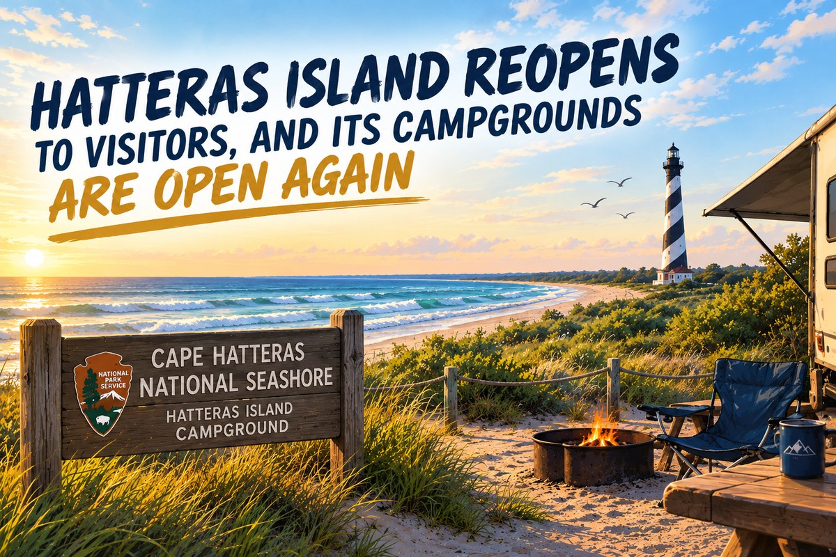
Hatteras Island has reopened to visitors, with Frisco and Cape Point campgrounds welcoming guests again.
Hatteras Island is open to visitors again. Dare County lifted its visitor evacuation order on Thursday, October 29, as N.C. 12 reopened near the Pea Island Visitor Center, a day ahead of the transportation department's Friday target, ending a closure that began with overwash on October 22. Visitors can again drive N.C. 12 across Pea Island and use the Ocracoke-Hatteras ferries, WRAL reports, though traffic remains slow through the repaired section.
Cape Hatteras National Seashore reopened its Frisco and Cape Point campgrounds at 4 p.m. Thursday, and most off-road vehicle ramps are open again, the park said; current ramp status is at go.nps.gov/beachaccess. The park asks visitors to use caution on Rodanthe beaches, where several oceanfront houses are still threatened and storm debris may be on the beach and in the water.
closedNC 12, Marc Basnight Bridge to Rodanthe; Hatteras Island to visitorsDare County, North CarolinaOne-lane detour targeted by noon Fri Oct 30; two lanes weeks awaychecked Oct 29
Crews were set to begin paving a one-lane detour on NC 12 at the Pea Island Visitor Center on Thursday, and the state transportation department is still aiming to open it to alternating one-way traffic by noon Friday, WCTI reports. Two-lane service is still weeks away, the Outer Banks Voice reports. Hatteras Island remains closed to visitors under Dare County's state of emergency, and the 24-hour emergency ferry from Stumpy Point to Rodanthe continues; anyone with a reservation should keep checking with their rental company and the county before traveling.
Correction, Oct. 30, 2026. Update: N.C. 12 reopened and Dare County lifted the visitor evacuation at 4 p.m. on October 29, a day earlier than the state's target, after this brief was published. Hatteras Island is open to visitors.
closedNC 12, Marc Basnight Bridge to Rodanthe; Hatteras Island to visitorsDare County, North CarolinaNCDOT aims for a one-lane detour by noon Fri Oct 30; emergency ferry 24/7checked Oct 28
Crews have begun tearing out damaged pavement at Pea Island, but king tides through Thursday could push more water over the road. Visitors are still barred, and the state plans to move a mile of the highway inland.
The North Carolina Department of Transportation says it aims to reopen N.C. 12 at the Pea Island Visitor Center with a one-lane detour, controlled by flaggers or automated signals, by noon Friday, October 30, WAVY reports. Crews have begun rebuilding dunes, removing damaged pavement and grading the roadbed, but standing water and continued overwash are slowing the work, and king tides through Thursday could bring more flooding, according to the Island Free Press. Once the single lane is open, the department plans to add sandbags along the dune line and then pave two full lanes.
Visitors still cannot enter Hatteras Island. Dare County's state of emergency and visitor evacuation remain in effect, entry is limited to its Priority One, Two and Three categories, and the county says no date has been set for visitors to return. Anyone with a reservation should contact their rental company and not travel toward the island. The 24-hour emergency ferry between Stumpy Point and Rodanthe had carried 3,117 people and 1,881 vehicles as of Monday; priority access does not mean priority loading, and those who need it must ask Dare County Emergency Management.
noticeFirearm deer openers: MN Nov 7, MI Nov 15, WI Nov 21, PA Nov 28Minnesota · Michigan · Wisconsin · PennsylvaniaCheck zones, licenses and blaze orange rules with each statechecked Oct 27
Minnesota goes first, then Michigan on November 15, Wisconsin's nine-day hunt on November 21 and Pennsylvania on November 28. Dates and zones below; confirm the details with each state.
Minnesota's firearms deer season opens Saturday, November 7. In the 100-series permit areas, most of the north, it runs through November 22; in the 200- and 300-series areas the A season runs November 7 to 15, and the 300-series B season November 21 to 29.
Michigan's regular firearm season opens on its traditional date, November 15, and runs through November 30 statewide, in both the Upper and Lower peninsulas.
More than 40 pitmasters and chefs, four all-you-can-eat barbecue villages, and $95 general admission, with proceeds for families of children with brain cancer.
An illustration of a Lowcountry barbecue festival's four styles of barbecue. Not a photo of Holy Smokes. Illustration
Holy Smokes, A Lowcountry Barbecue Festival, returns to Riverfront Park in North Charleston on Saturday, November 14, from 11 a.m. to 4 p.m., for its sixth year. More than 40 pitmasters and chefs from around the country will cook across four villages, Traditional, Texas, New School and Coastal, from whole hog to Texas brisket and smoked Lowcountry seafood, and every ticket includes all-you-can-eat access to all four, the Charleston visitors bureau says.
General admission is $95 and includes food and live music, with drinks for sale. VIP is $250, with food and drinks included, extra bites and a private bar. Children 7 to 13 are $25, and 6 and under get in free. Tickets are sold at holysmokeschs.com.
closedBlue Ridge Parkway: Roanoke Mountain Loop; MP 344.2–355.3 (Helene); MP 63.5–63.9 at the James River Bridge, detouredVirginia · North CarolinaPeaks of Otter, MP 76.4–85.9, open again; status 6:37 a.m. ET Oct 26checked Oct 26
The Blue Ridge Parkway between milepost 76.4 and 85.9, from the Apple Orchard parking area to Peaks Road and including Peaks of Otter Lodge, is open again, according to the park's road status page as of 6:37 a.m. Eastern Monday, October 26. Still closed: the Roanoke Mountain Loop at milepost 120.3, until further notice; milepost 344.2 to 355.3, from NC 80 to Mount Mitchell State Park, because of Hurricane Helene damage; and milepost 63.5 to 63.9 around the James River Bridge for rehabilitation, with a signed detour between mileposts 61.4 and 64. Hiking is prohibited at Crabtree Falls. The status page is updated each morning and can change during the day.
Cape Hatteras National Seashore will close part of the Sandy Bay parking lot from November 2 to about late January 2027 while Cape Hatteras Electric Cooperative replaces 15 wooden transmission poles with concrete structures between Sandy Bay and Hatteras Village, the park said October 26. Expect brief, intermittent lane closures on NC 12 when poles are delivered and removed. Access to Pamlico Sound for waterfowl hunting, fishing and other recreation stays open; avoid active work areas.
closedNC 12, Marc Basnight Bridge to Rodanthe; Hatteras Island to visitorsDare County, North CarolinaNo timeline; emergency ferry for permit holderschecked Oct 25
The damaged stretch near the Pea Island Visitor Center now exceeds 1,100 feet. Hatteras Island stays closed to visitors, and emergency ferry lines are long.
Ocean water crossed NC 12 near the Pea Island Visitor Center again at Sunday morning's high tide, the seventh straight day of ocean impacts on the same damaged stretch, the Island Free Press reports. The damage now covers more than 1,100 feet of highway, and there is still no confirmed timeline for reopening the road between the Marc Basnight Bridge and Rodanthe.
Dare County's state of emergency and mandatory evacuation for Hatteras Island visitors remain in effect, with no date announced for visitor entry. Only people in the county's Priority One, Two and Three categories may enter. Visitors already on the island can leave on the emergency ferry from Rodanthe to Stumpy Point but cannot return, and the same restrictions apply on the Cedar Island and Swan Quarter ferries through Ocracoke.
closedNC 12, Marc Basnight Bridge to Rodanthe; Hatteras Island to visitorsDare County, North CarolinaEmergency ferry Stumpy Point–Rodanthe; no reopening timelinechecked Oct 23
Dare County says there is no timeline for reopening NC 12 between the Marc Basnight Bridge and Rodanthe, and its state of emergency and visitor evacuation for Hatteras Island remain in effect. The emergency ferry between Stumpy Point and Rodanthe runs on a fixed NCDOT schedule from Friday for permit holders; visitors may use it to leave but not to return. Hyde County residents with documentation may use it to reach Ocracoke, where limited Hatteras–Ocracoke ferry service has resumed and NC 12 is open. The county's next bulletin is due by noon Friday.
closedNC 12, Marc Basnight Bridge to Rodanthe; Hatteras Island to visitorsDare County, North CarolinaEmergency ferry Stumpy Point–Rodanthe for permitted travelers onlychecked Oct 22
With a damaged stretch of NC 12 still cutting the road between the Marc Basnight Bridge and Rodanthe, the North Carolina Department of Transportation started emergency ferry service between Stumpy Point on the Dare County mainland and Rodanthe at 5 a.m. Thursday, October 22, Dare County said. Three boats are running around the clock, and each trip takes about two hours, WCTI reports.
The ferry is not for visitors. Dare County's state of emergency and its mandatory evacuation of Hatteras Island visitors remain in effect, and only people in the county's Priority One, Two and Three reentry categories may board for Rodanthe: essential personnel with a permit, permanent Dare County residents, critical-business staff, nonresident Hatteras Island property owners and island business employees. Anyone can leave the island.
closedNC 12, Marc Basnight Bridge to Rodanthe; Hatteras Island to visitorsDare County, North CarolinaState of emergency in effect; no reopening timechecked Oct 21
North Carolina transportation crews were assessing pavement damage on NC 12 at the Pea Island Visitor Center on Wednesday, October 21, and rebuilding protective dunes and adding sand along undamaged shoulders, WNCT reported, citing NCDOT. The highway remains closed from the Marc Basnight Bridge to Rodanthe, with significant blown sand in the canal zone, and NCDOT is asking people to avoid Pea Island.
Dare County's state of emergency for Hatteras Island remains in effect and visitors are still not allowed onto the island. Farther south, NC 12 is open on Ocracoke Island.
closedNC 12, Marc Basnight Bridge to Rodanthe; Hatteras Island to visitors; seashore ORV rampsDare & Hyde Cos., North CarolinaVisitor entry resumes only when Dare County announces itchecked Oct 20
Ocean overwash has closed North Carolina Highway 12 between the Marc Basnight Bridge over Oregon Inlet and Rodanthe, Dare County said, and the mandatory evacuation for Hatteras Island visitors remains in effect.
Visitors are not allowed onto Hatteras Island, and the county says visitor entry will resume only after the storm has passed and NC 12 is no longer threatened by overwash. Residents and people with Priority One, Two or Three reentry permits are authorized to enter, but that does not let anyone drive through the closed section; everyone must follow NCDOT barricades. The evacuation applies only to visitors on Hatteras Island, not to residents or to the beaches north of Oregon Inlet.
advisoryHigh surf advisories and high rip current risk, Southeast Georgia to Palm Beach CountyGeorgia · Florida Atlantic coastBreakers 6–12 ft, Mon to Wed morning; rip currents into Thuchecked Oct 19
The long coastal storm that closed Hatteras Island this weekend is now sending dangerous surf down the whole Southeast coast. Weather Service offices from Jacksonville to Miami have high surf advisories and high rip current risk on Monday, October 19.
The forecast breakers: 6 to 8 feet on the Southeast Georgia beaches until 5 a.m. Tuesday; 7 to 10 feet in Nassau, Duval, St. Johns and Flagler counties until 8 p.m. Tuesday, with minor coastal flooding along the beaches and the St. Johns River until 4 a.m. Thursday; 6 to 10 feet from Volusia through Martin County, including Brevard, until 4 a.m. Wednesday; 7 to 12 feet in Palm Beach County until 8 a.m. Wednesday; and 6 to 8 feet in Broward on Monday and Tuesday. High rip current risk runs through Wednesday night in northeast Florida and Thursday evening in South Florida.
closedHatteras Island to visitors; Ocracoke ferries; seashore campgrounds, ORV routes, lighthouse climbingDare & Hyde Cos., North CarolinaCoastal flood warning to 5 p.m. Tue; surf 9–14 ft to Thuchecked Oct 18
Hatteras Island remains closed to non-resident visitors under Dare County's state of emergency and evacuation order, Cape Hatteras National Seashore said Sunday, and Ocracoke Island cannot be reached because all ferry service from Hatteras Island, Swan Quarter and Cedar Island is suspended.
All seashore campgrounds, off-road vehicle routes and lighthouse climbing stay closed. Fort Raleigh National Historic Site and Wright Brothers National Memorial reopen at 9 a.m. Monday, October 19, and other facilities on the northern beaches are on their regular seasonal schedules.
advisoryHigh surf advisories and coastal flood warnings, Virginia Beach to Carteret CountyVirginia Beach, Va. · Currituck, Dare, Hyde & Carteret Cos., N.C.Surf 8–14 ft to Thu morning; flooding 1–4 ft to Tuechecked Oct 18
The high surf from this storm is now forecast to last into Thursday morning, October 22: 9 to 14 feet on Hatteras Island, 9 to 12 feet on the Northern Outer Banks, 8 to 14 feet at Virginia Beach and eastern Currituck, 8 to 10 feet on the Core Banks and 6 to 9 feet on Ocracoke. Coastal flood warnings on Hatteras and Ocracoke run until 5 p.m. Tuesday. Hatteras Island is closed to visitors in any case; elsewhere, this is surf for experienced surfers only, with dangerous rip currents and strong longshore currents.
closedCape Hatteras National Seashore campgrounds, ORV ramps and facilities; Fort Raleigh; Wright BrothersDare & Hyde Cos., North CarolinaClosed from noon Oct 17; Hatteras Island visitors under mandatory evacuationchecked Oct 17
Cape Hatteras National Seashore closed its campgrounds, off-road vehicle ramps and visitor facilities at noon Saturday, October 17, along with Fort Raleigh National Historic Site and Wright Brothers National Memorial, the Park Service said. They will reopen after conditions improve and post-storm assessments are done.
Dare County has declared a state of emergency and ordered a mandatory evacuation of visitors from Hatteras Island, and Hyde County, which includes Ocracoke, has issued an urgent warning to residents, property owners and visitors, according to the park.
advisoryHigh surf advisories; coastal flood watches and advisories, Virginia Beach to Carteret CountyVirginia Beach, Va. · Currituck, Dare, Hyde & Carteret Cos., N.C.Surf 8–14 ft; flooding 1–4 ft; Sat to Tue morningchecked Oct 16
Breakers of 8 to 14 feet from Saturday into Tuesday, and the Weather Service now warns of 2 to 4 feet of flooding on Hatteras and Ocracoke islands, where NC 12 may go under.
Update, 3:20 p.m. Pacific Friday: The Weather Service has widened and strengthened this weekend's warnings since this morning. It now covers the coast from Virginia Beach to Carteret County, adds coastal flooding, and runs into Tuesday.
The biggest surf is expected farthest north. In Virginia Beach and eastern Currituck County, the Wakefield office forecasts breaking waves of 10 to 14 feet from noon Saturday to 6 p.m. Monday. On the Northern Outer Banks and Hatteras Island, the Newport/Morehead City office expects 8 to 12 feet from 2 p.m. Saturday to 8 a.m. Tuesday; Ocracoke 6 to 9 feet and eastern Carteret County 7 to 10 feet, from midnight Saturday night to 8 p.m. Monday.
openU.S. 441/Newfound Gap Road; Carlos Campbell Overlook closedSevier Co., Tennessee · Swain Co., North CarolinaNot on park closure list Oct 13; no reopening releasechecked Oct 13
Great Smoky Mountains National Park's road closure page, updated October 13, no longer lists U.S. 441, Newfound Gap Road, which the park closed Friday night ahead of Hurricane Isaias, and the Blue Ridge Parkway's status table also shows it open. The park has not issued a release announcing the reopening. The closure page does list the Carlos Campbell Overlook on Newfound Gap Road as temporarily closed while crews assess cracks in the pavement and sidewalk, and Mingus Mill as closed for rehabilitation. Cosby Knob Shelter on the Appalachian Trail remains closed for bear activity. If you are driving across the park soon after the storm, check the park's road closure map first; the main switchboard is 865-436-1200.
closedBlue Ridge Parkway: MP 76.4–85.9 incl. Peaks of Otter Lodge; Roanoke Mountain Loop; Helene closure MP 344.2–355.3Virginia · North CarolinaStatus as of 7:35 a.m. ET Oct 13checked Oct 13
The Blue Ridge Parkway's last weather closure from Hurricane Isaias, milepost 455.7 to 469.1 from Soco Gap to U.S. 441 at the Smokies, is no longer listed as closed, according to the Parkway's road status as of 7:35 a.m. Tuesday.
One Virginia section that reopened Monday afternoon is closed again: milepost 76.4 to 85.9, from the Apple Orchard parking area to Peaks Road (VA 43), including Peaks of Otter Lodge, listed as "closed temporarily" with no reason or reopening time given. If you are booked at the lodge, call ahead.
closedBlue Ridge Parkway: MP 455.7–469.1, Soco Gap to U.S. 441; Roanoke Mountain Loop; Helene closure MP 344.2–355.3Virginia · North CarolinaWeather closure near the Smokies; status as of 1:59 p.m. ETchecked Oct 12
Update, 2 p.m. Eastern: Most of the Parkway has reopened. As of 1:59 p.m. Monday, the only weather closure left is milepost 455.7 to 469.1, from Soco Gap to U.S. 441 at the Smokies. The Virginia sections closed this morning for downed trees and rocks, including Peaks of Otter and the James River area, are listed open, as are Mount Mitchell State Park, Craggy Gardens and Beech Gap to Balsam Gap. Still closed for other reasons: the Helene section from NC 80 to Mount Mitchell (milepost 344.2 to 355.3), Roanoke Mountain Loop, and a short stretch at the James River Bridge (milepost 63.5 to 63.9) for bridge work. The Parkway's table now lists U.S. 441 through the Smokies as open but refers drivers to the Smokies for its status, and the Smokies had not posted a reopening when we checked. The original report from this morning follows.
Large sections of the Blue Ridge Parkway are closed after Hurricane Isaias, according to the Parkway's road status page as of 10:08 a.m. Monday. The park notes that status can change through the day.
The Appalachian Trail Conservancy is advising hikers to consider postponing trips on the southern part of the trail until Hurricane Isaias has passed. Its alert, posted Friday, says the storm's updated track brings heavy rain, flash flooding and high winds to the trail from Georgia through southwest Virginia, with possible heavy rain and flash flooding into central Virginia.
Areas hit by Hurricane Helene in 2024 are at particular risk because the landscape is still recovering. Wind can bring down trees and heavy rain can raise streams to dangerous levels and trigger landslides. Anyone on the trail during or right after the storm should stay well clear of standing dead, diseased or damaged trees, which can fall at any time.
closedU.S. 441/Newfound Gap Road; Balsam Mountain CampgroundSevier Co., Tennessee · Swain Co., North CarolinaFrom 8 p.m. Oct 9; high wind warningchecked Oct 9
Great Smoky Mountains National Park closes U.S. 441, Newfound Gap Road, at 8 p.m. tonight because of strong winds expected from Hurricane Isaias and the risk of downed trees and debris. Balsam Mountain Campground closed at 5 p.m. The road crosses the Appalachian Trail at Newfound Gap.
The National Weather Service has a high wind warning for the area starting today, with gusts to 70 mph possible on the Tennessee side of the park and moderate rain parkwide. Isaias is forecast to come ashore on the northern Gulf Coast and then move across the Southeast this weekend; the National Hurricane Center has the current track and warnings.
Overland Expo East runs October 23 to 25 at Oak Ridge Estate in Arrington, Virginia, the series' only East Coast show and its last of the year. Gates are open 9 a.m. to 5 p.m. Friday and Saturday and 9 a.m. to 3 p.m. Sunday.
The organizers list more than 200 exhibitors of overland, adventure travel, camping and motorcycle gear, and more than 175 classes, slideshows and demonstrations. There is rustic on-site camping in an open field, an evening film festival, and a charity dinner for the Overland Expo Foundation that is open only to campers and exhibitors. Tickets are sold through the event site.
National Hunting and Fishing Day falls on Saturday September 26, the same day as National Public Lands Day. State agencies run free family events for it, and they are more substantial than the name suggests: North Carolina is opening its hunter education complex with free muzzleloader, shotgun and rifle ranges, firearms and ammunition provided, plus archery, a skills trail and a falconry demonstration. West Virginia's event at Stonewall runs game butchering and wild game cooking demonstrations. If you have been meaning to get someone started, a day with free ranges and borrowed equipment is a cheaper introduction than a licence and a rifle.
Detours, demolished shelters and closed trailheads from North Carolina to New York, as the northbound season winds down and southbounders come through.
A stretch of the Appalachian Trail through the Appalachian Ranger District remains closed, with a detour in place at Iron Mountain Gap routing hikers around the last few miles, from roughly a mile south of the destroyed Cherry Gap Shelter to about a mile north of the gap. Fire restrictions have been in force in the Roan Mountain area since the storm raised the fire danger, and crews are still laying gravel by the thousands of tons on forest roads.
In Virginia, road reconstruction in the Mount Rogers National Recreation Area closed Whitetop Road and the Whitetop trailhead along with the observation point; the trail itself stays open where it crosses. Elk Garden and Beach Mountain are the alternates.
Overland Expo East runs October 23 to 25 at Oak Ridge Estate in Arrington, Virginia, in the Blue Ridge during peak colour. Organisers advertise 300-plus exhibitors and 150-plus classes, with advance pricing that steps up as the date closes in and again at the gate. Premium camping was down to single figures at last check; day, weekend and moto passes were still open. Class sign-ups open about two weeks out through the event app, and walk-ups are allowed. Parking is $10 a day and sold separately.
Chronic wasting disease keeps rewriting the fine print. Colorado now requires heads from every elk taken during rifle seasons in selected hunt codes, at no charge, and has dropped mandatory deer testing entirely for 2026. Hunters who want a deer tested anyway can submit voluntarily for $25.
Idaho requires testing for deer in seven units, adding 64 and 69 near Idaho Falls while removing 24 and 32A after two consecutive years with no detections. Units 14 and 18 and part of Unit 1 remain management zones, where testing is mandatory and whole carcasses may not leave the zone at all.