Overland Expo has posted its 2027 schedule, and the season starts in Costa Mesa, California, on March 13-14 with Overland Expo SoCal at the OC Fair & Event Center. Overland Expo West, the biggest in the series, returns to Fort Tuthill County Park in Flagstaff, Arizona, May 14-16, and Overland Expo PNW follows in Redmond, Oregon, June 25-27.
Overland Expo Mountain West moves to Riverdale Regional Park in Brighton, Colorado, for August 20-22; it was in Loveland in 2026. Overland Expo East closes the season at Oak Ridge Estate in Arrington, Virginia, October 22-24. In its 2026 review, Overland Expo said West drew 28,500 people and 420 exhibitors, and SoCal 19,000.
Toyota's overland-focused Trailhunter trim comes to the 2027 Tundra and Sequoia, Overland Expo's Compass reports from the SEMA Show. Both get Old Man Emu suspension, Michelin LTX tires, extra underbody protection, a locking rear differential, Crawl Control and Multi-Terrain Select, with 437 horsepower and 538 lb-ft of torque. The Tundra tows up to 12,000 pounds and the Sequoia 9,520. The Tacoma and 4Runner already offer the trim. Pricing wasn't given.
advisoryPCH southbound lane closures, Reef Point Dr to Irvine Cove DrCrystal Cove State Park, Orange County, CaliforniaEmergency slope repairs; closures in place until work is completechecked Nov 3
Southbound lanes of Pacific Coast Highway are partly closed between Reef Point Drive and Irvine Cove Drive while Caltrans stabilizes a 360-foot fracture in the slope above the beach.
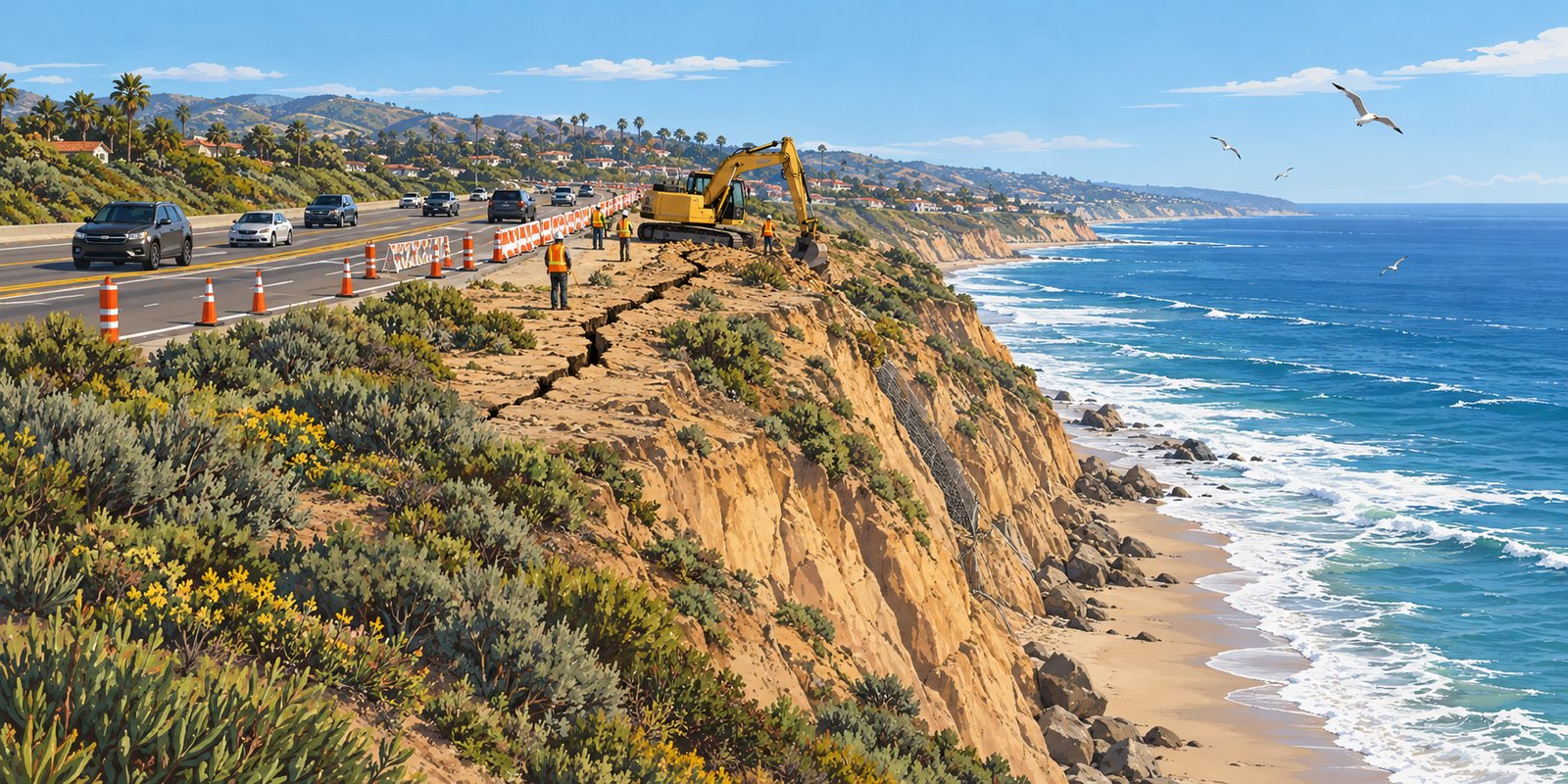
An illustration of a cracked coastal bluff beside a highway. Not a photo of the Crystal Cove site. Illustration
A crack in the bluff that holds up Pacific Coast Highway at El Morro, beside Crystal Cove State Park between Newport Beach and Laguna Beach, measures as much as 360 feet long and two feet wide, Caltrans says, according to Surfer. Caltrans closed the southbound right lane between Reef Point Drive and Irvine Cove Drive in mid-October and later added more partial closures as it moved to the second phase of emergency stabilization, Fox 11 reports. The closures stay in place until repairs are complete.
Caltrans has secured $4 million in initial emergency funding for a three-phase project that includes protecting the slope from wave erosion before winter storms, with a long-term fix to follow. The pressure from the ocean has been unusual: NOAA says El Niño-related ocean waves helped push water levels at gauges in Los Angeles, San Diego Bay, Santa Barbara and La Jolla to all-time records in late October, Surfer reports. On October 27, Gov. Gavin Newsom ordered a Highway 1 task force to prepare vulnerable stretches of the coast highway for winter.
advisoryRecreational Dungeness crab: opens Nov 7 with no traps; closed north of Fort BraggCalifornia coastHoop nets and snares only; no take or possession north of Fort Braggchecked Nov 2
Recreational Dungeness crabbing opens November 7, but only with hoop nets and snares, and not at all north of Fort Bragg because of domoic acid. The commercial season is delayed until at least January.
California's recreational Dungeness crab season opens Saturday, November 7, but with two big limits, ABC7 reports. Crab traps are not allowed, because of the risk of humpback whales becoming entangled, so crabbers will have to use hoop nets or crab snares. And north of Fort Bragg, where state scientists found unhealthy levels of domoic acid in crab, taking or possessing Dungeness crab is prohibited.
The commercial season is delayed until at least January 1, so local Dungeness crab isn't expected in stores or restaurants for the holidays. Active NorCal reports that three humpback whale entanglements triggered the state's rule, and that hoop-net crabbers must check their nets at least every two hours. The state's next risk assessment is expected in mid-to-late December, when the trap restriction could be lifted or changed.
closedTioga Road and Glacier Point Road, temporarily closed for snowYosemite National Park, CaliforniaNo overnight parking along either road; call 209-372-0200 for updateschecked Nov 1
Yosemite has temporarily closed Tioga Road, the continuation of Highway 120 through the park, and Glacier Point Road because of snow from this weekend's storm, the park's conditions page shows, with no overnight parking along either road. Tioga Road usually closes for the season sometime in November and stays closed until late May or June; when it's closed you can't reach Tuolumne Meadows or enter the park from the east. Snow can also close Wawona Road at times. For current road status and chain controls, call 209-372-0200 (press 1, then 1) before you drive.
Up to 18 inches in the Sierra high country and Colorado's San Juans and up to two feet in Utah's Cottonwood Canyons, with chain controls and difficult travel through Monday.
The first widespread mountain snowstorm of the season is crossing the West this weekend, and the National Weather Service has winter storm warnings and advisories from the Sierra Nevada to the Rockies.
In California, a winter weather advisory runs until 7 a.m. Sunday for Yosemite outside the valley, Sequoia and Kings Canyon, with 4 to 8 inches between 7,500 and 9,500 feet and up to 18 inches higher up. The northern Sierra, including Interstate 80 and Highway 50, could see up to 10 inches above 7,000 feet, with chain controls possible, and the Lake Tahoe area 2 to 5 inches above 7,000 feet. Nevada's Ruby Mountains and East Humboldt Range are under a winter storm warning through Sunday evening, with 12 to 16 inches above 7,500 feet and snow-covered roads through Lamoille Canyon.
advisoryPile burning: Big Stump, Grant Grove, Cedar Grove, Mineral KingSequoia and Kings Canyon NPs, CaliforniaNov 1 to Mar 15, conditions permitting; expect smokechecked Oct 30
Sequoia and Kings Canyon national parks will burn piles of cleared brush and small trees from November 1 through March 15, 2027, when weather, fuels, air quality and staffing allow, in the Big Stump, Grant Grove and Cedar Grove areas of Kings Canyon and the Mineral King area of Sequoia, the park said October 30. Expect smoke, burning piles, firefighters and equipment along park roads, and reduced visibility at times. The burning clears material from forest-restoration and defensible-space work that helps protect giant sequoias and park facilities from wildfire. Air quality updates are at fire.airnow.gov and valleyair.org.
A white shark estimated at 12 to 15 feet long swam within feet of surfers near Pier Avenue in Oceano, San Luis Obispo County, on Wednesday morning, October 28, then flicked its tail, splashed surfer Joel Hendrix and swam away, leaving everyone unharmed, Surfer magazine reports from drone video and the San Luis Obispo Tribune. Fall is a busy season for adult white sharks along the Central Coast. If you see one or a beach posts a warning, get out of the water calmly, tell a lifeguard if one is on duty, and give the area time; many California beaches post shark advisories for several days after a sighting.
California's recreational Dungeness crab season is scheduled to reopen Saturday, November 7, the California Department of Fish and Wildlife's regional fishing pages say. In most of the state it runs through June 30; in Del Norte, Humboldt and Mendocino counties, through July 30.
The scheduled date is not a guarantee. In recent seasons the department has restricted or delayed crab traps because of humpback whales and sea turtles near the coast, and state health agencies have delayed openers in Northern California when crab carried unhealthy levels of domoic acid. Sign up for the department's Whale Safe Fisheries notices and check its current notices before you go; you can also call the domoic acid closure line at 831-649-2883.
advisoryCoastal flood warning, Orange and San Diego county coasts; advisory from San Luis Obispo to Los AngelesSouthern California coastThrough 1 p.m. Thu; worst at late-morning high tideschecked Oct 27
The Weather Service warns of significant coastal flooding at late-morning high tides, with an atmospheric river due this weekend. Beach lots, bike paths and boardwalks are going under from Ventura to the border.
The National Weather Service has a coastal flood warning for the Orange County and San Diego County coasts until 1 p.m. Thursday, October 29, for significant flooding during the late-morning high tides. Numerous roads may be closed, and low-lying homes, businesses and some infrastructure could be inundated, the San Diego office says. From San Luis Obispo County to the Los Angeles County beaches, including Malibu, Ventura and Santa Barbara and the Channel Islands, a coastal flood advisory warns of minor to moderate flooding over beach parking lots, bike paths and harbor walkways, and moderate to significant beach erosion.
These are king tides, the year's highest astronomical tides, running even higher than predicted. Newport Beach officials have reported water 15 to 22 inches above forecast levels, which Surfer magazine attributes to an El Niño-driven ocean wave that has raised sea level along the coast; Tuesday's high tide in Newport was expected to reach a record 8.5 feet. Several cities have declared local emergencies and built sand berms.
closedArea east of Wawona Road, south of Glacier Point Road, north of Wawona, east to the Bridalveil Creek trailheadWawona, Mariposa Co., CaliforniaChilnualna Falls trail reopened; rest of the area still closedchecked Oct 26
The trail to the top of Chilnualna Falls has reopened, Yosemite's current conditions page says. Still closed after the Dome Fire, which was fully contained October 18: the area east of Wawona Road, south of Glacier Point Road and north of Wawona, extending east to the Bridalveil Creek trailhead, south of the Ostrander Lake trail. Glacier Point Road itself is open, with no overnight parking. The park's public information map shows the closure boundary.
openTrails in the Grant Grove area, Kings Canyon National ParkKings Canyon NP, CaliforniaOpen; check the Kings Canyon Visitor Center for conditionschecked Oct 26
Trails within the Grant Grove area of Kings Canyon National Park are open, the park's conditions page says, after the 482-acre prescribed burn that began October 17 closed several of them on a rolling basis. The Kings Canyon Visitor Center has the most current trail conditions; smoke can linger near burned areas for days.
advisoryBeach hazards statement: rip currents and elevated surfVentura & Los Angeles Cos., CaliforniaSurf 3–6 ft through late Thursday nightchecked Oct 21
The Weather Service's Los Angeles office has a beach hazards statement for the Ventura County beaches, Malibu and the Los Angeles County beaches through late Thursday night, for dangerous rip currents and breaking waves from 3 to 6 feet of surf. Minor beach erosion and tidal overflow are possible on south-facing beaches, especially along Malibu and in the Long Beach area. Swim near lifeguards and stay off rocks and jetties.
Lifeguards at Huntington and Bolsa Chica logged more than 3,500 incidents this year. The warm water bringing them, and dorado and yellowfin, should last through winter.
Lifeguards at Huntington and Bolsa Chica state beaches have recorded more than 3,500 stingray incidents so far in 2026, compared with just over 1,400 in all of 2025, California State Parks superintendent Bryan Entyre told the Department of Fish and Wildlife's marine management blog. Round stingrays hide under a dusting of sand in shallow water and sting waders who step on them; the stings are rarely lasting but painful.
The likely driver is warm water. A marine heat wave and a strong El Niño have both been confirmed in the Pacific, the department notes, citing NOAA, and the unusually warm water along California's coast will very likely continue as El Niño arrives this fall and winter.
closedTrails in the Dome Fire footprint: south- and eastbound trails off Glacier Point Road, Ostrander, Mono Meadow, Buena VistaWawona, Mariposa Co., California6,788 acres, 100% contained; trail closures not yet liftedchecked Oct 18
The Dome Fire in Yosemite is 100 percent contained at 6,788 acres, according to the federal incident report filed Saturday evening, with 235 people still assigned. Containment is not the same as reopening: the park has not announced any change to the trail closures inside the fire footprint, including Ostrander, Mono Meadow and Buena Vista, and its last release still listed them closed. Glacier Point Road and the Chilnualna Falls, Alder Creek, Four Mile and Panorama trails are open. Check Yosemite's conditions page before heading into the burned area.
advisoryGrant Grove Day Ride Loop (Oct 17); General Grant Tree Trail, North Grove Loop, Grant Tree Road (Oct 18); part of Sunset Trail (Oct 19)Kings Canyon National Park, CaliforniaPrescribed burn from Oct 17; reopen when clearedchecked Oct 17
The Grant Grove prescribed burn in Kings Canyon National Park, first planned for October 13, now begins October 17, weather permitting, the park said in an update. It covers 482 acres, a little less than the 521 acres first announced.
Closures roll out over three days. The Grant Grove Day Ride Loop Trail closes October 17. The General Grant Tree Trail, the North Grove Loop Trail and Grant Tree Road close October 18, so the General Grant Tree itself is off limits from Sunday. Portions of the Sunset Trail close October 19. Everything reopens once it is cleared of hazards.
advisoryBeach hazards statement: sneaker waves and rip currentsMarin, San Francisco, San Mateo & Santa Cruz Cos., CaliforniaBreakers 7–12 ft, 3 a.m. Sat to 9 p.m. Sunchecked Oct 16
The Weather Service office in San Francisco has a beach hazards statement for Pacific Coast beaches from Point Reyes through San Francisco and the Peninsula coast to northern Monterey Bay, from 3 a.m. Saturday to 9 p.m. Sunday. It warns of an increased risk of sneaker waves and strong rip currents with breakers of 7 to 12 feet; sneaker waves can sweep across the shoreline without warning and pull people off beaches, jetties and rocks. Never turn your back on the ocean, and stay well back from the waterline and off rocks and jetties.
closedTrails in the Dome Fire footprint: south- and eastbound trails off Glacier Point Road, Ostrander, Mono Meadow, Buena VistaWawona, Mariposa Co., California6,788 acres, 95% contained; Glacier Point Road openchecked Oct 16
The federal incident report filed Thursday evening, the day Yosemite was scheduled to take command of the Dome Fire back from the interagency team, shows 278 people still assigned, down from 524 a day earlier. The fire holds at 6,788 acres and 95 percent contained. Glacier Point Road and the Chilnualna Falls, Alder Creek, Four Mile and Panorama trails are open; the trails inside the fire footprint, including Ostrander, Mono Meadow and Buena Vista, remain closed.
OC Parks is placing up to 9,000 cubic yards of sand at Capistrano Beach in Dana Point, with construction scheduled from October 12 through October 30. The sand comes from a quarry in San Juan Capistrano. Parts of the beach may be closed to the public while the work is under way.
The work comes after surf from Tropical Storm Rachel hit the south Orange County coast hard. The City of Dana Point said Monday that seven homes in the Capistrano Bay District had been red-tagged and 13 yellow-tagged, with two demolished and one more scheduled for demolition, local station ABC7 reported. Erosion has also taken out a parking lot and threatened the rail line along the beach.
advisoryBeach hazards: elevated surf, rip currents, minor tidal floodingVentura, Los Angeles, Orange & San Diego Cos., CaliforniaThrough 2 p.m. Oct 15; surf 3–5 ft, sets to 6checked Oct 15
Surf of 3 to 5 feet with sets to 6 in San Diego and Orange counties, plus rip currents and minor tidal flooding from Ventura to the border, through 2 p.m. Thursday.
The National Weather Service has beach hazards statements in effect for the Southern California coast through 2 p.m. Thursday, October 15, as a long-period south swell lines up with some of the year's higher tides.
In San Diego and Orange counties, the San Diego office expects surf of 3 to 5 feet with sets to 6 feet and high tides of 6.5 to 7 feet late this morning, bringing minor coastal flooding, beach erosion and dangerous swimming conditions for inexperienced swimmers. Tides fall below 6.5 feet after today's high, but the south swell continues today.
closedTrails in the Dome Fire footprint: south- and eastbound trails off Glacier Point Road, Ostrander, Mono Meadow, Buena VistaWawona, Mariposa Co., California6,788 acres, 95% contained; Glacier Point Road openchecked Oct 15
California Interagency Incident Management Team 4 is scheduled to hand command of the Dome Fire back to Yosemite National Park today. The fire is 95 percent contained at 6,788 acres with no perimeter change in several days, and staffing is down to 524 people in the latest federal report. Crews are patrolling, hauling out hose and equipment by mule and helicopter, and repairing hand lines to limit erosion. Warmer, drier weather with light winds holds through today. Glacier Point Road is open; every trail inside the fire footprint, including Ostrander, Mono Meadow and Buena Vista, stays closed, while Chilnualna Falls, Alder Creek, Four Mile and Panorama are open.
The Bouquet Fire is 100 percent contained at 1,048 acres, the Angeles National Forest says, and nothing remains closed. The Drinkwater OHV area and forest roads 6N18 (Saugus del Sur) and 6N19 (Quarry Road) reopened at 4 p.m. Monday, October 12. Rowher Flat reopened, and all evacuation orders were lifted, on Friday evening, October 9.
The fire started October 3 near Bouquet Canyon Road south of Bouquet Reservoir and grew quickly in brush that had not burned in decades. The federal incident report puts the final cost at about $4.5 million.
closedTrails in the Dome Fire footprint: south- and eastbound trails off Glacier Point Road, Ostrander, Mono Meadow, Buena VistaWawona, Mariposa Co., California6,788 acres, 95% contained; Glacier Point Road openchecked Oct 13
Update, 8:15 p.m. Tuesday: The federal incident report filed this evening raises containment to 95 percent, from 86 percent this morning, with 596 people still assigned, down from 746. The acreage is unchanged at 6,788. Closures have not changed.
Containment on the Dome Fire has reached 86 percent, the incident's InciWeb page says, with no change to the perimeter in several days. The fire stands at 6,788 acres. Activity is minimal, and any smoke visible is from pockets of heat in the interior. The federal incident report shows 746 people still assigned, down from more than 900 last week, and an estimated final cost of $60 million.
closedTrails in the Dome Fire footprint: south- and eastbound trails off Glacier Point Road, Ostrander, Mono Meadow, Buena VistaWawona, Mariposa Co., California6,788 acres, 73% contained; Glacier Point Road openchecked Oct 12
The federal incident report filed Sunday evening puts the Dome Fire at 73 percent contained and 6,788 acres, with 906 personnel; the park had not posted a Monday update when this was written. Rain and snow showers are forecast through tonight. Glacier Point Road is open, and the trails inside the fire footprint, including Ostrander, Mono Meadow and Buena Vista, remain closed. All crews have been flown out of their wilderness spike camps by helicopter ahead of the storm, and crews have started hauling out about 12 miles of hose along with pumps, tanks, generators and fuel cans.
The Bouquet Fire is 93 percent contained at 1,048 acres, according to the federal incident report filed Sunday evening, with 46 people still assigned. All evacuations have been lifted and Rowher Flat is open, but the Drinkwater OHV area and forest roads 6N18 and 6N19 remain closed.
advisoryGeneral Grant Tree Trail, North Grove Loop, Grant Grove Day Ride Trail, part of North Boundary TrailTulare & Fresno Cos., CaliforniaPrescribed burn from Oct 13; temporary closures during ignitionschecked Oct 12
Sequoia and Kings Canyon National Parks plan to start a prescribed burn in the Grant Grove area on Tuesday, October 13, weather permitting. The burn covers 521 acres west of Highway 180, including areas near the General Grant Tree.
During ignitions, the General Grant Tree Trail, the North Grove Loop, the Grant Grove Day Ride Trail and a segment of the North Boundary Trail will be temporarily closed. The park says it will keep the closures as short as possible and reopen trails as soon as operations finish. Weather and air quality will be checked before ignitions, and the dates may change.
closedTrails in the Dome Fire footprint: south- and eastbound trails off Glacier Point Road, Ostrander, Mono Meadow, Buena VistaWawona, Mariposa Co., California6,805 acres, 69% contained; Glacier Point Road openchecked Oct 11
Every control line on the Dome Fire held through Saturday's wind, the Park Service says. Fire activity picked up with the gusts, but burning stayed in the interior and never threatened containment, which now stands at 69 percent. The park lists the fire at 6,805 acres, 24 fewer than Friday's 6,829; reported acreage is often revised as the perimeter is remapped, and the park did not explain the change. There are 926 people assigned.
With the fire largely held, the work is shifting. Crews will patrol the lines, mop up and begin hauling out equipment no longer needed, while mule trains keep supplying remote sections. Fire managers have cut back the number of spike camps in the wilderness ahead of the weather.
closedTrails in the Dome Fire footprint: south- and eastbound trails off Glacier Point Road, Ostrander, Mono Meadow, Buena VistaWawona, Mariposa Co., CaliforniaGlacier Point Road open; fire 6,829 acres, 61% containedchecked Oct 10
Glacier Point Road reopened at 7 a.m. Saturday, October 10, Yosemite National Park says. It had been closed for the Dome Fire since September, for smoke, visibility and firefighter access. The park asks drivers to go slowly and watch for firefighters working along the road.
The trails inside the fire are another matter. Every trail within the active fire footprint is still closed, including all of the south- and eastbound trails that start from Glacier Point Road, the Ostrander Lake Trail and everything south of it, and the Mono Meadow and Buena Vista trails. The Chilnualna Falls, Alder Creek, Four Mile and Panorama trails are open.
All evacuation orders for the Bouquet Fire were lifted at 6 p.m. Friday, October 9, the Angeles National Forest says, and the Rowher Flat OHV area reopened at 5 p.m. the same day. The Drinkwater OHV area remains closed for public safety, along with forest roads 6N18 (Saugus del Sur) and 6N19 (Quarry Road).
Our Friday edition did not have this; the forest's update came after we checked.
closedGlacier Point Road; Ostrander, Mono Meadow and Buena Vista trails and the fire areaWawona, Mariposa Co., California6,829 acres, 61% containedchecked Oct 9
Containment on the Dome Fire rose to 61 percent on Thursday, up from 47 percent, the Park Service said this morning. The fire is 6,829 acres with 968 people assigned. Fire activity was minimal, and aircraft working with hotshot crews kept it inside its footprint.
Today crews are mopping up and patrolling the north and west sides. On the east side, still the top priority, they are running hose lines down from the north and up from the south and finishing hand line, and structure protection stays at the Ostrander ski hut.
The last evacuation order on the Bouquet Fire has been cut back to the burned area itself. Zone LAC-E030-A now covers only the fire footprint, the Angeles National Forest says, and residents in Bouquet Canyon are not affected. Every other order and warning was lifted earlier in the week.
The fire is 83 percent contained at 1,048 acres, according to the federal incident report filed Wednesday evening, up from 74 percent in the forest's morning update. There are 131 people still assigned, and the estimated cost is $2.7 million.
closedGlacier Point Road; Ostrander, Mono Meadow and Buena Vista trails and the fire areaWawona, Mariposa Co., California6,815 acres, 47% containedchecked Oct 8
The Dome Fire has stayed within its footprint, the incident's InciWeb page says, and holds at 6,815 acres and 47 percent contained with 916 people assigned. Tree-felling crews are taking down standing dead trees in the 2017 Empire Fire burn, where they are a constant hazard to crews below, and firefighters are building hand line directly on the fire's eastern edge. The mule string has hauled 106 loads, 12,237 pounds of cargo, in just over a week. Warm, dry weather holds through today. Closures are unchanged: Glacier Point Road and the trails in the fire footprint, including Ostrander, Mono Meadow and Buena Vista, are closed; Chilnualna Falls, Alder Creek, Four Mile and Panorama trails are open.
The California Department of Fish and Wildlife has released a draft Bobcat Conservation and Management Plan, the first in the state's history, and is taking written comments through November 1. Bobcat hunting and trapping have been illegal in California since 2020 except under limited circumstances such as a depredation permit, and that law requires a plan like this before a season can even be considered.
Five years of study found bobcats throughout the state with a stable population of more than 62,000, similar to the department's estimates from 1977 and 1981. The 133-page draft lists vehicle strikes and disease, especially mange, as the leading known causes of death.
closedGlacier Point Road; Ostrander, Mono Meadow and Buena Vista trails and the fire areaWawona, Mariposa Co., California6,815 acres, 47% containedchecked Oct 7
The trail to the top of the falls is open again, and containment climbed to 47 percent by Wednesday evening. The fire's estimated cost rises to $60 million.
Update, 5:45 p.m. Wednesday: The federal incident report filed this evening raises containment to 47 percent, from 41 percent this morning, with 916 personnel. The park's morning release put the fire at 6,815 acres. It also confirms the Chilnualna Falls and Alder Creek reopenings below and says the Buena Vista Trail remains closed. Warm, dry weather is expected through Thursday.
The Chilnualna Falls Trail is open again from the Wawona trailhead to the top of the falls, close to where the Dome Fire started on September 15. Yosemite's conditions page says the trail to the top of Chilnualna Falls has reopened, and the incident's InciWeb page says it is open east to the falls and to Crescent Lake. The Alder Creek Trail is open north to the Deer Camp Trailhead.
Update, 5:45 p.m. Wednesday: Bouquet Canyon Road reopened at 12:30 p.m. today, the Angeles National Forest says. The incident page's summary paragraph still describes the road as closed from Spunky Canyon to milepost 5.7, but its later, timestamped line gives the reopening; we are going with the reopening. Forest roads 6N18 and 6N19 and the Drinkwater and Rowher Flat OHV areas remain closed. Containment is unchanged at 74 percent.
The Bouquet Fire northeast of Santa Clarita is 74 percent contained, the Angeles National Forest said today. Activity was light overnight, with some interior pockets still smoldering. Crews are gridding for leftover heat, starting near the line and working inward, and suppression repair has begun where the fire is contained.
noticePorcupine Flat, Crane Flat and Tamarack Flat campgroundsYosemite National Park, CaliforniaClose Oct 11–12; no overnight road parking from Oct 15checked Oct 7
Yosemite's campground season is winding down. Porcupine Flat closes for the year on October 11, and Crane Flat and Tamarack Flat close October 12, according to the park's conditions page. Bridalveil Creek, White Wolf, Yosemite Creek and Tuolumne Meadows are already closed.
That leaves Upper, Lower and North Pines and Camp 4 in Yosemite Valley, plus Wawona and Hodgdon Meadow outside it. All require reservations; the park lists no first-come, first-served sites. Camping or sleeping in a vehicle is allowed only in a campsite you are registered for, and if the park's campgrounds are full you must leave the park to camp.
Permits are required at the Imperial Sand Dunes from October 1 to April 15. The Cahuilla station is coming down, and Cement Flats is closed to camping.
The permit season at the Imperial Sand Dunes Recreation Area, the BLM's busiest site, began October 1 and runs to April 15. A permit is required for the primary vehicle, the street-legal one that brings you there. Weekly permits are $55 bought in advance and $70 on site, and a season permit is $185. Buy them online at isdpermits.net or from approved off-site vendors.
The big change this season is the ranger station. The BLM vacated the Cahuilla Ranger Station off Gecko Road in April and plans to demolish it late this year, with a new station due in summer 2028. Until then, a temporary ranger station at Cement Flats sells permits and has emergency medical trailers for walk-in injuries.
The Bouquet Fire northeast of Santa Clarita is 67 percent contained, the Angeles National Forest said today, and most of the evacuation orders and warnings have been lifted. The fire is holding at about 1,048 acres. Activity is minimal, with some pockets still smoldering inside the burned area; a drone flight overnight showed crews where the remaining heat is.
Evacuation orders are lifted for zones LAC-E018 and LAC-E031, and warnings are lifted for LAC-E016, LAC-E017, LAC-E019, LAC-E020, LAC-E021 and LAC-E029. The forest's update now lists one zone still under an evacuation order, LAC-E030-A. Earlier lists had LAC-E030-A as a warning and LAC-E030-B as an order, and today's update does not mention LAC-E030-B, so check the county's Genasys Protect map for both before going home. The shelter at the Castaic Sports Complex, 31230 Castaic Road, remains open and takes small pets.
closedGlacier Point Road; Ostrander, Mono Meadow and Buena Vista trails and the fire areaWawona, Mariposa Co., California6,760 acres, 40% containedchecked Oct 6
The Dome Fire is 6,760 acres and 40 percent contained, the Park Service said Monday morning, with 1,063 people assigned. Crews kept the fire from growing on its north, west and south sides on Monday and made good progress building line on the eastern edge, where it is still active, the incident's InciWeb update says. Helicopters flew 29 missions.
Today crews are working from both the north and the south to close the line on the east side, using broad areas of granite as firebreaks where they cannot attack the fire directly. Mule trains are hauling equipment and supplies to remote crews, which frees helicopters for water drops. The federal incident report filed Monday evening lists 915 personnel and an estimated final cost of $40 million.
A wildfire in the Angeles National Forest northeast of Santa Clarita has burned about 1,048 acres since Saturday afternoon. The Bouquet Fire started near Bouquet Canyon Road south of Bouquet Reservoir and is burning in chaparral and grass on steep ground with limited access. The Forest Service's incident record puts discovery at 2:16 p.m. Saturday; CAL FIRE's start time, as reported by local outlets, is 3:19 p.m.
Fire activity was minimal overnight into Monday, forest officials said, and the size and containment were unchanged Monday morning. Crews are building and improving line, concentrating near homes and private property. Officials warned that rising temperatures could increase fire activity again this afternoon.