Vol. I  ·  No. 71
Sunday, November 22, 2026  · 
🔍 Search  ·  451 stories in the archive

Front page › Back issues › Wednesday, November 18, 2026

Wednesday, November 18, 2026

14 stories in this edition

Gear

Backcountry Buys Christy Sports and Its 50-Plus Mountain Shops

The online retailer takes over a ski rental and retail chain founded in 1958; no store closures are planned and existing rentals will be honored.
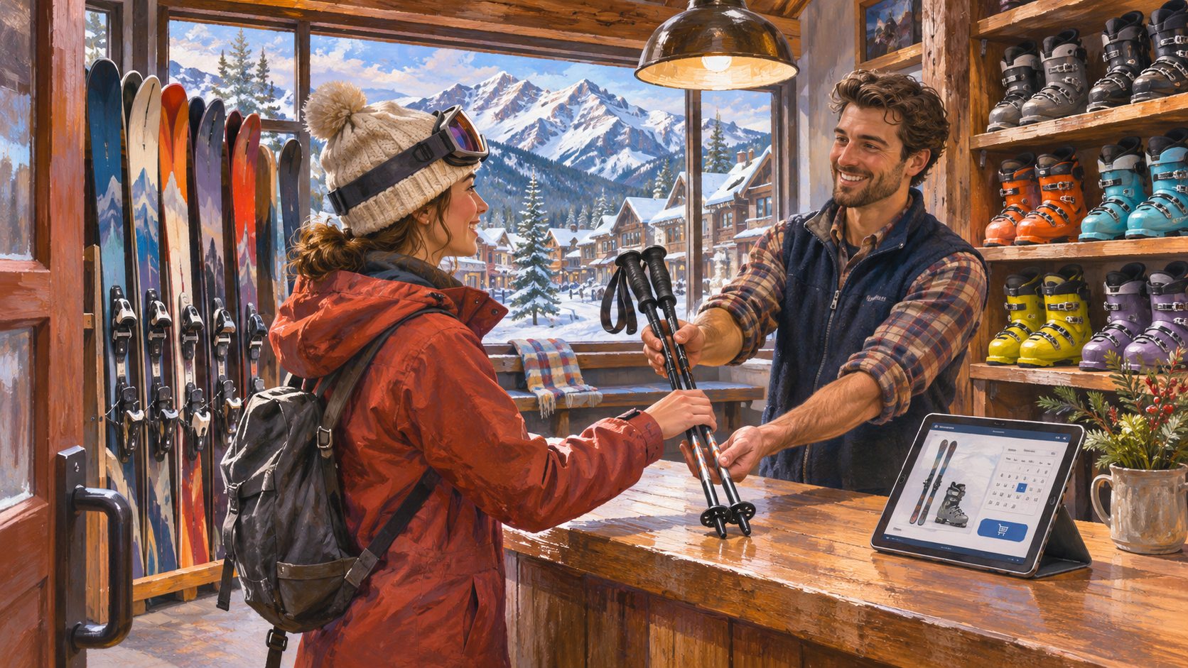
Painted illustration of a shop employee handing ski poles to a customer in a mountain-town ski shop, with skis, boots and a tablet on the counter, and snowy peaks outside.
AI-generated editorial illustration of a mountain ski shop. Illustration

Backcountry, the Utah-based online outdoor retailer, said Wednesday that it has acquired Christy Sports, the ski and outdoor chain with more than 50 stores in Colorado, Utah, Washington and Montana. Terms were not disclosed.

Christy Sports keeps its name. Its shops include locations in Vail, Breckenridge, Steamboat Springs, Aspen and Winter Park, along with stores that trade under other names: Bootdoctors, The Alpineer, Sturtevant's, Ski Mart, Leisure Living and Powder Tools. Backcountry already runs about 10 stores of its own, opened since 2021.

For skiers and riders this season, the companies say nothing closes. Rental reservations, season rental agreements, gift cards and service tickets already booked with Christy Sports will be honored. Customers will be able to reserve rental gear on Backcountry's website and pick it up at a Christy Sports shop, and Backcountry's Summit+ loyalty benefits will extend to discounted rentals and in-store services.

Christy Sports chief executive Lindsay Goszulak becomes chief financial officer of Backcountry Group, which also owns Steep'n'Cheap, Competitive Cyclist and MotoSport. Backcountry president Kevin Lenau said the aim is for the advice a customer gets online to follow them to the rental counter.

Christy Sports has operated in mountain towns since 1958. If you have a rental or tune booked over Thanksgiving, the companies say no action is needed.

Sources
Field Notes

Driving to the Mountains for Thanksgiving: Know Your Chain Rules First

The first big Sierra storm of the season lands just before the busiest travel week of the fall. A few minutes of reading now saves an hour on the shoulder later.

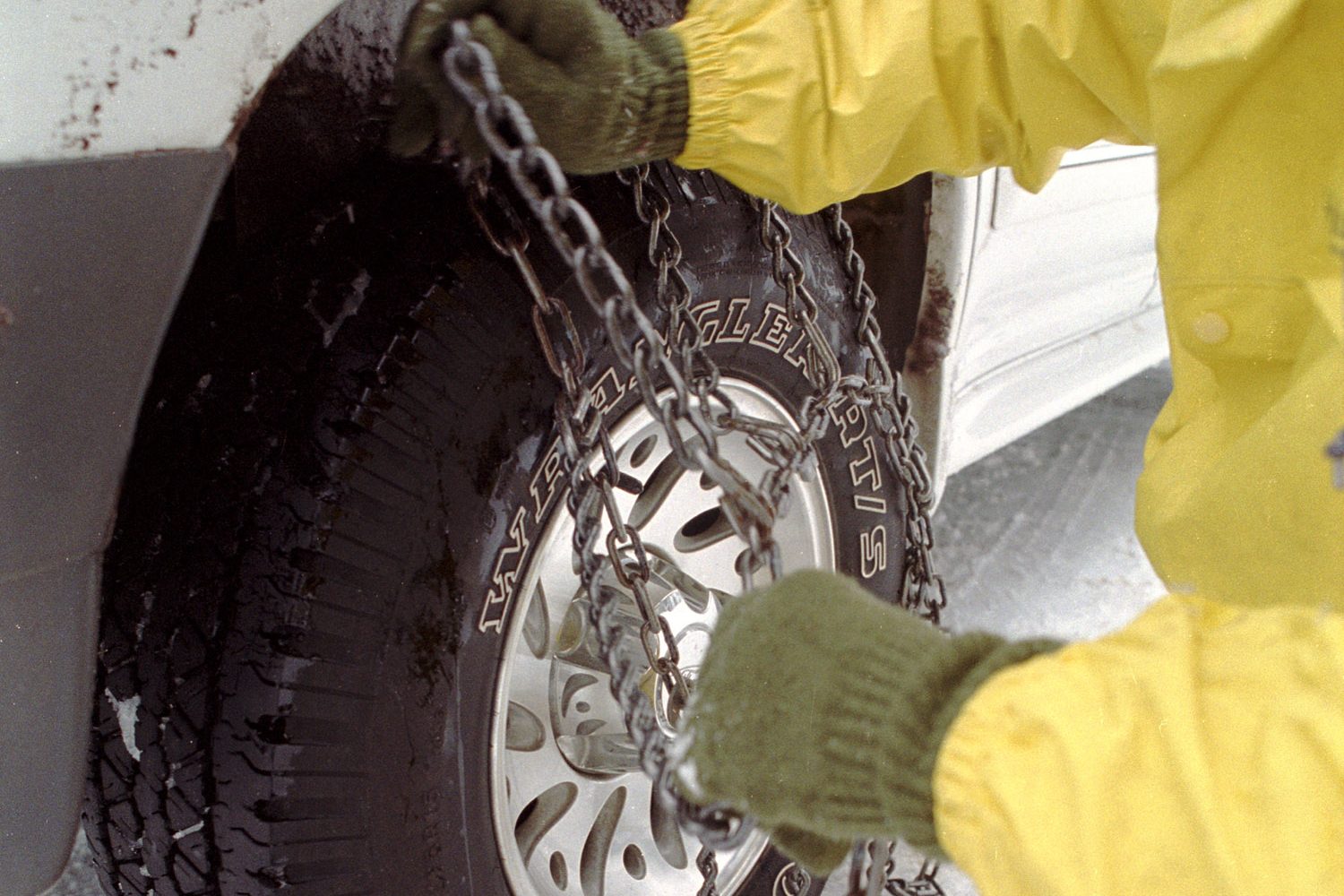
Gloved hands in a yellow rain jacket fit a tire chain over the wheel of a white pickup standing in snow.
File photo from the Oregon Department of Transportation, dated November 2004: fitting a chain to a pickup's tire in the snow. Photo: Oregon Department of Transportation, CC BY 2.0, via Wikimedia Commons

This week's Sierra storm is a preview of what holiday travel into the mountains looks like: winter storm warnings, chain controls on the passes and a line of cars on the shoulder of the highway while drivers try to figure out their chains for the first time. Most of that is avoidable with a little preparation before you leave the house.

Start with the rules. In California, Caltrans posts three levels of chain control. Under R-1, chains are required, but passenger vehicles and light trucks under 6,000 pounds can go without them if they have snow tires on at least two drive wheels. Under R-2, four-wheel and all-wheel drive vehicles with snow-tread tires on all four wheels are exempt; everyone else needs chains or traction devices. Under R-3, every vehicle needs them, with no exceptions, and Caltrans says the road is often closed before it gets to that point.

The part people miss: even when you are exempt, you have to carry chains. Caltrans says vehicles using snow tires under R-1 must carry chains, and four-wheel and all-wheel drive vehicles must carry traction devices in chain control areas. An all-wheel drive car with no chains in the trunk is one condition change away from being turned around.

Practice once in the driveway, in daylight, with dry hands. The first time you fit chains should not be in slush, in the dark, with trucks going by. When the signs say chains are required, Caltrans says you will usually have about a mile before the checkpoint. Pull completely off to the right; do not stop where you block traffic. The speed limit with chains on is 25 or 30 mph. If you pay a roadside chain installer, get a receipt and note the badge number: installers are independent businesses, not Caltrans employees, and they are not allowed to sell or rent chains.

Then pack the car as if you might sit still for a few hours. Ready.gov's car kit list is short: jumper cables, flares or a reflective triangle, an ice scraper, a phone charger that plugs into the car, a blanket, a paper map, and cat litter or sand for traction. Add water, snacks, warm layers and a flashlight for everyone in the car. Keep the gas tank full, which also helps keep the fuel line from freezing, and turn off cruise control on snowy or icy roads.

Last, check before you go and again on the way. Conditions change quickly on mountain passes. Caltrans QuickMap and the CHIN line at 800-427-7623 show current chain controls and closures in California; other states run their own 511 systems. Ready.gov's advice for bad weather is the simplest of all: drive only if you really have to. Leaving a day early, or a morning late, is often the best piece of winter gear there is.

Sources

BBQ

Watch: Meat Church's Thanksgiving turkey, a week out

Matt Pittman's full walk-through for a smoked holiday bird.

Meat Church BBQ, All My Secrets for the BEST Thanksgiving Turkey! (Nov. 18). Meat Church BBQ on YouTube

Meat Church BBQ's Matt Pittman posts his Thanksgiving turkey method a week before the holiday, in time to plan the brine and the cook. Use a meat thermometer and follow USDA's food safety guidance for poultry.

Videos play from the creator's own YouTube channel. Outdoor Unc does not take payment to feature a video.

Sources

Gear

Watch: GearJunkie's REI holiday wish list

GearJunkie's editors pick REI-brand gear they would want as gifts.

GearJunkie, The REI Gear We'd Put on Our Holiday Wish List (Nov. 18). GearJunkie on YouTube

GearJunkie's editors go through REI Co-op's own-brand gear they would put on a holiday list. Picks and opinions are theirs; Outdoor Unc carries no affiliate links.

Videos play from the creator's own YouTube channel. Outdoor Unc does not take payment to feature a video.

Sources

Overlanding

Watch: Revere Overland on sizing a portable power station

How to match a battery to what you actually run in camp.

Revere Overland, Which Portable Power Station is Right for Your Overlanding Setup? (Nov. 18). Revere Overland on YouTube

Revere Overland looks at how to choose a portable power station for a vehicle-based camp setup. The video's description includes sponsor or affiliate links.

Videos play from the creator's own YouTube channel. Outdoor Unc does not take payment to feature a video.

Sources

advisory Flash flood watch, Timber and Plaskett burn scarsBig Sur, Monterey Co., CaliforniaThrough 4 a.m. Thu. Hwy 1 from Andrew Molera SP to Partington Ridge, and mile markers 11–17 incl. Los Burros Road; debris flows possible. Visitors told to avoid the areachecked Nov 18

Trail reports

Flash Flood Watch on Big Sur Burn Scars; County Says Stay Away

Heavy rain over the Timber and Plaskett burn areas could send debris flows across Highway 1 through early Thursday, and Monterey County is telling visitors to avoid Big Sur.

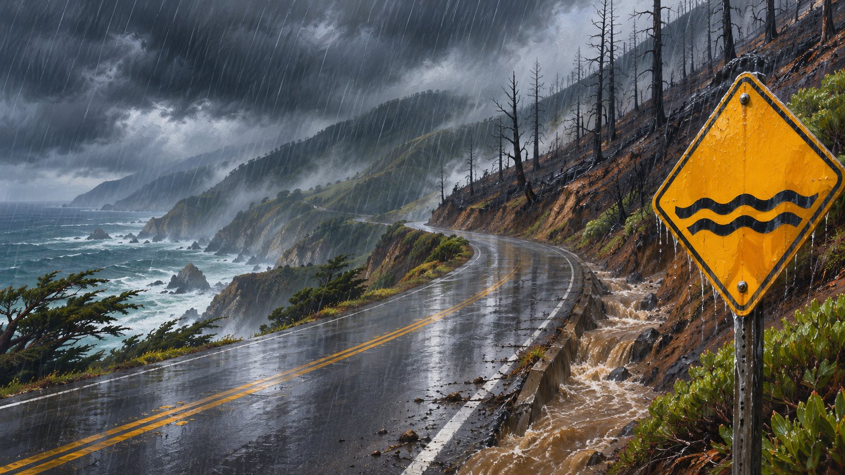
Painted illustration of a wet coastal highway curving along Big Sur cliffs in heavy rain, with muddy water pouring off a burned hillside beside a yellow warning sign.
AI-generated editorial illustration of flash flood risk on Big Sur's burn scars. Illustration

The National Weather Service in San Francisco has a flash flood watch over the Big Sur burn scars from the Timber and Plaskett fires, reissued at 4:46 a.m. Pacific on Wednesday and running until 4 a.m. Thursday. It warns that heavy rain could cause flash flooding in low areas, flooded roads and debris flows in and near the burn areas.

For the Timber scar, the watch covers parts of Highway 1 and Los Padres National Forest from Andrew Molera State Park to Partington Ridge, including the town of Big Sur, with debris flows possible in Lafler, Castro and Graves canyons and the drainages between Grimes and Castro canyons. For the Plaskett scar, it covers Highway 1 from mile marker 11 to mile marker 17 and Los Burros Road, with Alder, Plaskett and Prewitt creeks named. Big Sur, Plaskett and Pfeiffer Big Sur State Park are listed as places that could flood.

Monterey County said Tuesday that it is "highly likely" rain will pass the thresholds for debris flows and flash floods. It is asking visitors to avoid Big Sur, residents to stay off the roads once the storm starts, and people whose homes are at risk to consider leaving before it arrives. It told residents and businesses to stock up while the roads are open and to be ready to manage on their own for up to two weeks if slides close Highway 1. KSBW reported the highway was open as of Tuesday afternoon.

The NWS Bay Area office expects 2 to 4 inches of rain near Big Sur and 3 to 5 inches in the Santa Lucia Range, CBS San Francisco reported. Separately, Caltrans had scheduled daytime closures of Highway 1 near Torre Canyon Bridge on Wednesday and Thursday, weather permitting, to hang slope netting, according to a Caltrans notice reposted by the Big Sur Kate blog.

A Forest Service order restricting public access to the Monterey Ranger District of Los Padres National Forest, with some exceptions, runs through Jan. 31. Check Caltrans QuickMap and Alert Monterey County before driving south of Carmel.

Sources

advisory Winter storm warnings, through 4 a.m. Fri.Sierra Nevada, Lake Tahoe and the Eastern Sierra, California and NevadaTahoe: 2–4 ft above 7,000 ft, 1–2 ft at lake level, ridgetop gusts forecast to 100 mph. Mono Co.: 2–4 ft west of US 395. Snow 1–2 in. an hour Wednesdaychecked Nov 18

Snow

Sierra Storm Hits; Tahoe Schools Close, Ridge Gusts Could Reach 100 mph

Heavy snow is due through Thursday, with Heavenly and Northstar still planning to open Friday and Palisades Tahoe on Saturday.

The storm forecast all week reached the Sierra on Wednesday. Tahoe Truckee Unified called a snow day for all of its schools, and Washoe County closed its Incline Village schools because of the weather and roads, KOLO reported early Wednesday. Lake Tahoe Unified opened on an early-release schedule.

The winter storm warnings run to 4 a.m. Friday. The National Weather Service's Reno office still calls for 2 to 4 feet above 7,000 feet around Lake Tahoe and 1 to 2 feet at lake level, but its warning now puts ridgetop gusts as high as 100 mph, with whiteouts at times, Weatherboy reported from the Tuesday forecasts. Reports early Tuesday gave 80 mph. In Mono County, the warning calls for 2 to 4 feet west of US 395 and 10 to 20 inches along the highway, and the Las Vegas office warns that whiteouts on the Eastern Sierra slopes of Inyo County could make travel life-threatening.

The heaviest snow is expected Wednesday morning and afternoon, at 1 to 2 inches an hour, with snow levels around 4,500 to 5,500 feet. The warnings say travel could be very difficult to impossible through the Thursday commute. Check Caltrans QuickMap or 511, and Nevada's nvroads.com, before leaving.

Heavenly and Northstar are set to open on Friday, Nov. 20, their planned dates, Fox Reno reports, and Palisades Tahoe has moved its opener up to Saturday. Kirkwood plans to open before its Dec. 4 target but has not named a date.

Sources

notice Razor clam digs, Copalis and Mocrocks beachesGrays Harbor Co., WashingtonNov 24 Mocrocks, Nov 25–26 Copalis, Nov 27–28 Mocrocks; evening tides, digging noon to midnight; 15 clams a day. Long Beach, Twin Harbors and Kalaloch closedchecked Nov 18

Fishing

Washington Approves Five Razor Clam Digs Over Thanksgiving Week

Copalis and Mocrocks open on alternating evening tides Nov. 24 to 28; Long Beach and Twin Harbors stay closed for marine toxin.

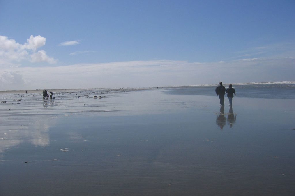
Two people walk across wide, wet sand at low tide while others bend over digging in the distance, under a blue sky.
File photo: razor clam diggers on the beach at Ocean Shores, Washington, part of the Copalis digging area, May 2007. Photo: Emily Diehl, CC BY-SA 3.0, via Wikimedia Commons

The Washington Department of Fish and Wildlife approved five days of razor clam digging on Tuesday, all on evening low tides: Mocrocks on Tuesday, Nov. 24 (6:02 p.m., -1.7 feet); Copalis on Wednesday, Nov. 25 (6:48 p.m., -1.9 feet) and Thanksgiving Day, Nov. 26 (7:35 p.m., -1.8 feet); and Mocrocks again on Friday, Nov. 27 (8:25 p.m., -1.4 feet) and Saturday, Nov. 28 (9:18 p.m., -0.8 feet). Digging is allowed only between noon and midnight.

"This upcoming tide series features some of the best tides of the fall season with Thanksgiving right in the middle," said Bryce Blumenthal, the department's coastal shellfish biologist. He also warned that the clam population on both beaches "isn't what it had been in previous years," so diggers may need to move around to fill a limit. The department expects fewer digging days this season.

The daily limit is 15 clams, and diggers must keep the first 15 they dig regardless of size or condition, each person's in a separate container. Anyone 16 or older needs a 2026-27 license. On the beach the speed limit is 25 mph; enter only at marked access points and drive on the hard sand near the high-tide line.

Long Beach and Twin Harbors stay closed until further notice because domoic acid, a natural algae toxin, is still above state health limits, though clam numbers there are near average. Kalaloch stays closed because its clam population is still low. The department says to check the surf forecast before going, especially when swells over 11 feet are forecast.

Sources

advisory High surf advisory, San Luis Obispo and Santa Barbara Central Coast beachesSan Luis Obispo and Santa Barbara Cos., CaliforniaBreakers 10–19 ft, local sets 20–22 ft; peak late Wed. through Thu. night; advisory until 9 p.m. Fri.; minor coastal flooding 3–10 a.m. Thu.checked Nov 18

Surfing

Central Coast Surf Builds to 19 Feet, With Sets Near 22

The National Weather Service's Los Angeles/Oxnard office has a high surf advisory for San Luis Obispo County beaches and the Santa Barbara County Central Coast until 9 p.m. Friday, with breaking waves of 10 to 19 feet and local sets of 20 to 22 feet, peaking from late Wednesday through Thursday night, KSBY reports. A coastal flood advisory covers the same beaches from 3 to 10 a.m. Thursday, and flood watches for heavy rain cover both counties Wednesday and Thursday. Farther north, a high surf advisory for the San Francisco and Monterey Bay coasts runs to 4 p.m. Thursday, with breakers of 12 to 17 feet.

Sources

Snow

Watch: skiing steep ice, a new Atomic boot and K2's Manifest

A Ski Addiction lesson for hard, steep snow, plus two 2027 gear reviews.

Ski Addiction, Steep And Icy? Stop Fighting It (Nov. 17). Ski Addiction on YouTube

Ski Addiction works through technique for steep, firm early-season slopes. SkiEssentials, a ski retailer, reviews Atomic's 2027 Remedy 130 boot, and Angry Snowboarder reviews K2's 2027 Manifest board; the Angry Snowboarder video's description includes sponsor or affiliate links.

Videos play from the creator's own YouTube channel. Outdoor Unc does not take payment to feature a video.

Sources

Surfing

Watch: day five of the Taiwan Open of Surfing

The World Surf League's broadcast from Jinzun Harbor.

World Surf League, Day 5 of the Taiwan Open of Surfing 2026 (Nov. 18). World Surf League on YouTube

The World Surf League's broadcast of the fifth day of competition at the Taiwan Open of Surfing, a Qualifying Series event at Jinzun Harbor, streamed live and available to replay.

Videos play from the creator's own YouTube channel. Outdoor Unc does not take payment to feature a video.

Sources

Hunting

Watch: Randy Newberg's quick muzzleloader elk hunt and goHUNT's late-season deer kit

A Fresh Tracks episode from a muzzleloader elk season.

Fresh Tracks (Randy Newberg), That Didn't Take Long! | Muzzleloader Elk (Nov. 17). Fresh Tracks on YouTube

Randy Newberg, who films do-it-yourself hunts on public land, posts a muzzleloader elk hunt that, by his title, ended fast. Check the state's season dates and tag rules before hunting elk. The video's description includes sponsor or affiliate links.

goHUNT adds a rundown of the gear one of its hunters carries for late-season deer. Its description also includes sponsor or affiliate links.

Videos play from the creator's own YouTube channel. Outdoor Unc does not take payment to feature a video.

Sources

Off-road

Watch: a stuck RV recovery and a Jeep Gladiator build to study

The Hurricane, Utah, recovery crew retrieves a motorhome from a trail it wasn't built for.

Matt's Off Road Recovery, Their RV Got STUCK… It Wasn't Built For This! (Nov. 18). Matt's Off Road Recovery on YouTube

Matt's Off Road Recovery, which pulls stuck and broken-down vehicles off trails around Hurricane, Utah, goes after an RV that got stuck off pavement. The video's description includes sponsor or affiliate links.

TrailRecon, which makes beginner-friendly off-road how-tos, walks through a built Jeep Gladiator as a reference for planning one.

Videos play from the creator's own YouTube channel. Outdoor Unc does not take payment to feature a video.

Sources

Fishing

Watch: budget bass gear and a saltwater step-up guide

Starter rods and reels for bass, and the next step up for saltwater.

Tactical Bassin', 2026 Buyer's Guide: Best Budget Fishing Rods and Reels for Beginners and Entry Level Bass Anglers (Nov. 18). Tactical Bassin' on YouTube

Tactical Bassin' picks lower-priced rods and reels for anglers starting out in bass fishing, the latest in its 2026 buyer's guide series. The video's description includes sponsor or affiliate links.

Salt Strong, which teaches inshore saltwater fishing, adds a step-up guide to saltwater rods and reels for anglers past the beginner stage.

Videos play from the creator's own YouTube channel. Outdoor Unc does not take payment to feature a video.

Sources