Vol. I  ·  No. 58
Monday, November 9, 2026  · 
274 stories in the archive

Front page › Back issues › Monday, October 26, 2026

Monday, October 26, 2026

8 stories in this edition

closed Blue Ridge Parkway: Roanoke Mountain Loop; MP 344.2–355.3 (Helene); MP 63.5–63.9 at the James River Bridge, detouredVirginia · North CarolinaPeaks of Otter, MP 76.4–85.9, open again; status 6:37 a.m. ET Oct 26checked Oct 26

Trail reports

Blue Ridge Parkway Reopens the Peaks of Otter Section

The Blue Ridge Parkway between milepost 76.4 and 85.9, from the Apple Orchard parking area to Peaks Road and including Peaks of Otter Lodge, is open again, according to the park's road status page as of 6:37 a.m. Eastern Monday, October 26. Still closed: the Roanoke Mountain Loop at milepost 120.3, until further notice; milepost 344.2 to 355.3, from NC 80 to Mount Mitchell State Park, because of Hurricane Helene damage; and milepost 63.5 to 63.9 around the James River Bridge for rehabilitation, with a signed detour between mileposts 61.4 and 64. Hiking is prohibited at Crabtree Falls. The status page is updated each morning and can change during the day.

Sources
closed Area east of Wawona Road, south of Glacier Point Road, north of Wawona, east to the Bridalveil Creek trailheadWawona, Mariposa Co., CaliforniaChilnualna Falls trail reopened; rest of the area still closedchecked Oct 26

Trail reports

Chilnualna Falls Trail Reopens in the Dome Fire Area

The trail to the top of Chilnualna Falls has reopened, Yosemite's current conditions page says. Still closed after the Dome Fire, which was fully contained October 18: the area east of Wawona Road, south of Glacier Point Road and north of Wawona, extending east to the Bridalveil Creek trailhead, south of the Ostrander Lake trail. Glacier Point Road itself is open, with no overnight parking. The park's public information map shows the closure boundary.

Sources

open Razor clam digs: Mocrocks Oct 26 and 29; Copalis Oct 27 and 28Grays Harbor Co., WashingtonNoon to midnight; Long Beach and Twin Harbors closedchecked Oct 26

Fishing

First Razor Clam Dig of the Season Is Tonight at Mocrocks

Digging is allowed noon to midnight, with low tide at 7:18 p.m. Copalis follows Tuesday and Wednesday, and Mocrocks again Thursday.

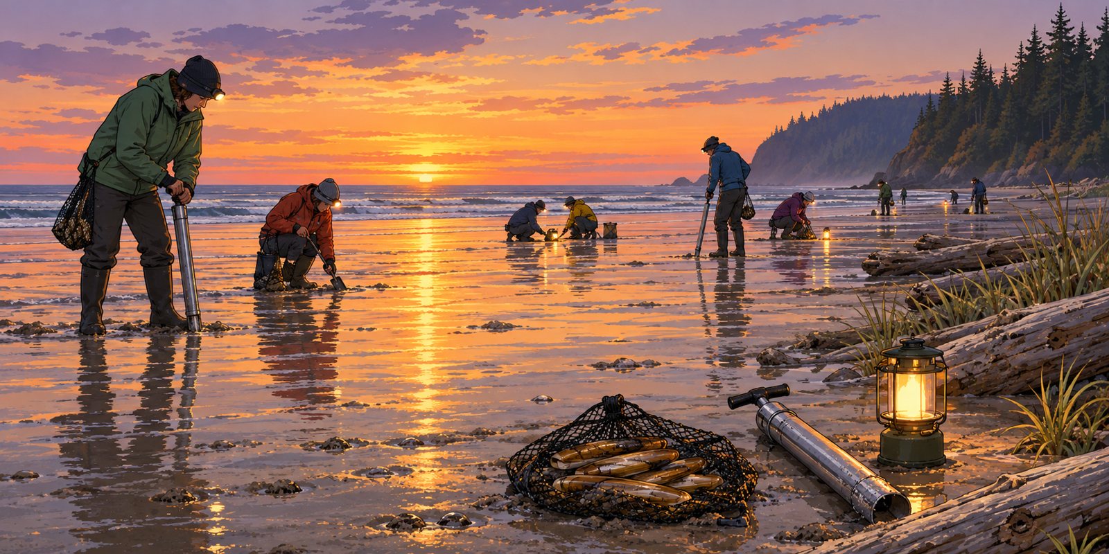
Illustration of razor clam diggers at sunset on a wide, wet Washington beach, some with clam guns and headlamps, others kneeling with shovels, lanterns glowing, with a net bag of clams, a clam gun and a lantern in the foreground and a forested headland in the distance
An illustration of an evening razor clam dig on the Washington coast. Not a photo of tonight's dig. Illustration

Washington's first razor clam dig of the season is tonight, Monday, October 26, at Mocrocks Beach, with low tide at 7:18 p.m. at minus 1.2 feet. Digging is allowed only from noon to midnight; the best time is one to two hours before low tide.

The rest of the series: Copalis on Tuesday, October 27 (low tide 8:01 p.m.) and Wednesday, October 28 (8:47 p.m.), and Mocrocks again on Thursday, October 29 (9:38 p.m.). Long Beach and Twin Harbors remain closed because of marine toxins, and the department expects fewer digging days than usual at Copalis and Mocrocks this season.

Diggers need a valid Washington license that covers razor clams. Toxin tests can cancel a dig on short notice, so check the department's emergency rules page before driving to the coast, and bring a lantern or headlamp for the evening tides.

Sources

closed Wonderland Trail, Carbon River Suspension Bridge to White River Campground; Northern Loop; Grand Park trailsMount Rainier National Park, WashingtonWonderland Complex fires still active; Sunrise and White River roads closed for winterchecked Oct 26

Trail reports

Wonderland Trail Stays Closed on Rainier's North Side

Mount Rainier's Wonderland Trail remains closed from the Carbon River Suspension Bridge to White River Campground, along with the Northern Loop Trail and all trails in the Grand Park area, until further notice, the park says. The Grand Park Fire 2 and the West Fork, Garda Falls and Pigeon fires, known together as the Wonderland Complex, are still active and expected to burn until extinguished naturally. The Sunrise and White River roads have also closed for the winter season.

Sources

closed Stillaguamish River, Marine Drive to the forks near ArlingtonSnohomish Co., WashingtonAll species, through Nov 1checked Oct 26

Fishing

Stillaguamish River Fishing Closure Runs Through November 1

The Stillaguamish River from Marine Drive to the forks near Arlington stays closed to all fishing through November 1 under the emergency rule Washington Fish and Wildlife issued October 7. Check the department's emergency rules page before fishing after that date, in case the closure is extended.

Sources

notice Partial closure, Sandy Bay parking lotCape Hatteras National Seashore, N.C.Nov 2 to late Jan 2027checked Oct 26

Trail reports

Sandy Bay Parking Lot Partly Closes November 2 for Power Work

Cape Hatteras National Seashore will close part of the Sandy Bay parking lot from November 2 to about late January 2027 while Cape Hatteras Electric Cooperative replaces 15 wooden transmission poles with concrete structures between Sandy Bay and Hatteras Village, the park said October 26. Expect brief, intermittent lane closures on NC 12 when poles are delivered and removed. Access to Pamlico Sound for waterfowl hunting, fishing and other recreation stays open; avoid active work areas.

Sources

open Trails in the Grant Grove area, Kings Canyon National ParkKings Canyon NP, CaliforniaOpen; check the Kings Canyon Visitor Center for conditionschecked Oct 26

Trail reports

Grant Grove Trails Are Open Again After the Prescribed Burn

Trails within the Grant Grove area of Kings Canyon National Park are open, the park's conditions page says, after the 482-acre prescribed burn that began October 17 closed several of them on a rolling basis. The Kings Canyon Visitor Center has the most current trail conditions; smoke can linger near burned areas for days.

Sources

closed Chehalis River, part of the Grays Harbor system closureGrays Harbor Co., WashingtonAll species from Oct 24, until flows improvechecked Oct 26

Fishing

Chehalis River Advisory Gives Way to a Full Fishing Closure

The September advisory about possible tribal citations on the Chehalis River near Oakville has been overtaken by a full closure: the Chehalis, with the rest of the Grays Harbor and Willapa Bay river systems, has been closed to salmon and all game fish since October 24 because of near-record low flows, Washington Fish and Wildlife says. The department may reopen rivers if flows rise.

Sources